U-2 Spy Planes & Aerial Archaeology
West Merle-Smith Gallery on the Lower Level
Included with Museum Admission
West Merle-Smith Gallery on the Lower Level
Included with Museum Admission
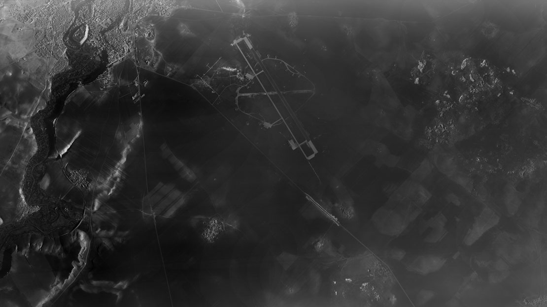
Archaeologists use all kinds of tools to find out about the past–even top-secret images taken by spy planes. Declassified photographs captured by U2 aircraft in the 1950s and 60s are yielding new insights today, helping to recover lost histories.
Through large-scale printed images and a small selection of objects from the Penn collection, this exhibition offers a closer look at the United States military’s top-secret aerial reconnaissance during the 1950s and 1960s, the key geographic features and lost landscapes they captured accidentally, and the role of “aerial archaeology.”
Archaeologists use many more tools than just the shovel, pick, and trowel. Aerial and satellite images from this time provide researchers with a view of settlements and ancient environmental features that have since been altered due to urban expansion and agriculture. Many important traces of ancient societies—like road networks and irrigation systems—are only visible from an aerial view.
This exhibition stems from a larger research project by scholars at Penn and Harvard, who embarked on a mission to reconstruct the flight paths of the U2 planes and build a spatial index of images that is accessible to everyone.
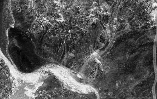
Ur (Tell al-Muqayyar) was one of the earliest and longest-lived ancient cities in southern Iraq. The main settlement mounds of Ur were once surrounded by a city wall that enclosed an area of 50-60 hectares. Soil discoloration and mounding visible in U2 photographs suggest that the city was originally much larger than this and incorporated several suburbs.
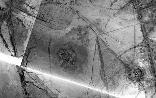
U2 photographs show the thin stone walls of prehistoric hunting traps, called "desert kites," located in the black basalt desert (Harra) of eastern Jordan. This is today an inhospitable desert, devoid of people except for isolated roads, but thousands of years ago it was a land of plenty for hunters and herders.
The exhibition is curated by Dr. Emily Hammer, Assistant Professor in the Department of Near Eastern Languages and Civilizations and the Price Lab for the Digital Humanities at the University of Pennsylvania School of Arts and Sciences.