Qalatgah

An Urartian Site in Northwestern Iran

By: Oscar W. Muscarella

Originally Published in 1971

View PDF

Modern archaeological interest in Urartu and its culture has several phases. The first, which lasted until around 1945, started in the 1870’s, when, after several objects reported to have come from Urartu appeared on the market, the British Museum began to dig at Toprakkale in modern Turkey. After a short time, D. Raynolds, an American missionary, and E. Clayton, a British vice-consul, resumed work at Toprakkale for the Museum. Meanwhile, objects were continuously being purchased by various people from local in­habitants, and these, together with the few ob­jects and architectural elements being excavated, formed a corpus of Urartian art. When in 1898 C. C. Lehmann-Haupt and V. Belck began what may be considered the first attempt at scientific excavation of Toprakkale—the others could only be called treasure hunts—they had a good idea what they expected. In 1911-12, two Russian scholars, M. J. Marr and I. A. Orbelli, did some more digging at Toprakkale, and at nearby Van, but interest soon petered out. Serious excavation did not begin again until 1937-38, when an American expedition led by Kirsopp Lake under­took a campaign at both Toprakkale and Van.

Red-slipped pottery vase from Agrab Tepe decorated by burnishing and excised triangles filled with white paste. Height, 56, cm. Museum Object Number: 65-36-2
Red-slipped pottery vase from Agrab Tepe decorated by burnishing and excised triangles filled with white paste. Height, 56, cm.
Museum Object Number: 65-36-2

Russian scholars became interested in that part of ancient Urartu presently situated within the Soviet Union’s borders, after 1930. At that time survey teams began to seek out and record Urartian sites and inscriptions. In 1939, B. B. Piotrovskii began one of the most significant ex­cavations ever undertaken in Urartian archae­ology: the site of Karmir Blur (Red Hill), near Erivan in Soviet Armenia. Work there continues to the present and one may argue that the results achieved by Piotrovskii have played a large role in reviving interest in Urartu.

We see, then, that British, American, Ger­man, and Russian archaeologists were initially in­volved in the discovery of Urartu’s past.

The period after the Second World War be­gins the second, and more intense, phase of Urart­ian scholarship. This phase is marked by very active archaeological campaigns led by Turkish scholars working within their borders. Intensive and extremely important surveys were also con­ducted mostly by British scholars, who discovered many Urartian sites and who made it possible to define the borders of Urartu within Turkey. At the same time, Russian archaeologists surveyed and excavated other Urartian sites and cemeteries within their borders. American scholars played little or no active role in Urartian archaeology at this time.

A third phase of Urartian archaeology began with recent discoveries in northwestern Iran that made it clear, not only that Urartians set up in­scriptions in that area, but also, and more im­portant, that they built cities there.

In 1859 the Hermitage Museum received a group of Urartian objects said to have come from Alishar (modern Shotlu) on the Iranian shore of the Araxes River, near Mt. Ararat. And in 1905, at Guschi on the northwestern shore of Lake Rezaiyeh, peasants found a hoard of Urar­tian objects in a tomb. These objects, and a hand­ful of scattered inscriptions, were all that scholars could study if they were interested in the problem of Urartian penetration into Iran. But it is of interest to note that no archaeologists seem to have taken an interest in seeking out possible Urartian sites in Iran. In 1964 the situation be­gan to change. The Hasanlu Project of the Uni­versity Museum and the Metropolitan Museum of Art, under the general direction of R. H. Dy­son, Jr., and the field direction of T. Cuyler Young, Jr. and the author, excavated a small fort at a site we called Agrab Tepe, situated near Hasanlu in the Solduz valley. Here we unearthed pottery that has good parallels at sites in Urartu. While we are still not sure what the nature of the fort was, we were aware at the time of excavation that the site had some cultural contacts with Urartu. In 1968 the German Archaeological Institute conducted the most important survey of northwestern Iran to date, and Wolfram Kleiss, the leader of the survey, published his results in 1970. Kleiss discovered about a dozen Urartian sites north of Shapur, and he began to excavate one called Bastam, north of Khoy. In the same year Charles Burney, who had worked in Turkey on surveys and who excavated an Urartian site there, found evidence of Urartian culture at Haf­tavan, near Shapur. And again in 1968, the Has­anlu Project team discovered the Urartian site of Qalatgah, which is the subject of this article.

View looking north toward Qalatgah (rising to the right behind the trees) as seen from Sé Girdan.
Western edge of the Qalatgah site lies on lower slope of nearby mountain (left) . The seal was found along with sherds in the low rise in the right center of the photograph.
West slope of the main site of Qalatgah showing remaining stone blocks (in situ) of the fortification wall.

We look forward to continuous cooperation with our Iranian hosts and colleagues in north­western Iran. Joint work on the part of all scholars interested in ancient Iran will, we trust, generously expand our very limited knowledge about both Urartian history in Iran and the nature of the material and spiritual culture developed there.

When travelling or excavating in the Near East, archaeologists often hear from local villagers or workmen reports about the existence of stones with writing, or the whereabouts of an ancient city. Too often the stone with writing turns out to be a rough boulder covered with grooves and scratches caused by weathering, or a weathered gravestone, or a millstone no longer in use; and the alleged ancient city is actually a hill with outcropping rocks, or a deserted Moslem cemetery.

Nevertheless, one is sometimes given valuable in­formation about an object or site, and it is the duty of the archaeologist not to be cynical after many false alarms, but to investigate every claim about ancient remains made by local peoples. Thus, a few years ago T. Cuyler Young, Jr. heard from his workmen at Godin Tepe in central west­ern Iran about a stone statue. As a routine matter he went to the place where the statue was said to be and there found a stone stela of Sargon II of Assyria (722-704 B.C.), thereby making an im­portant historical discovery.

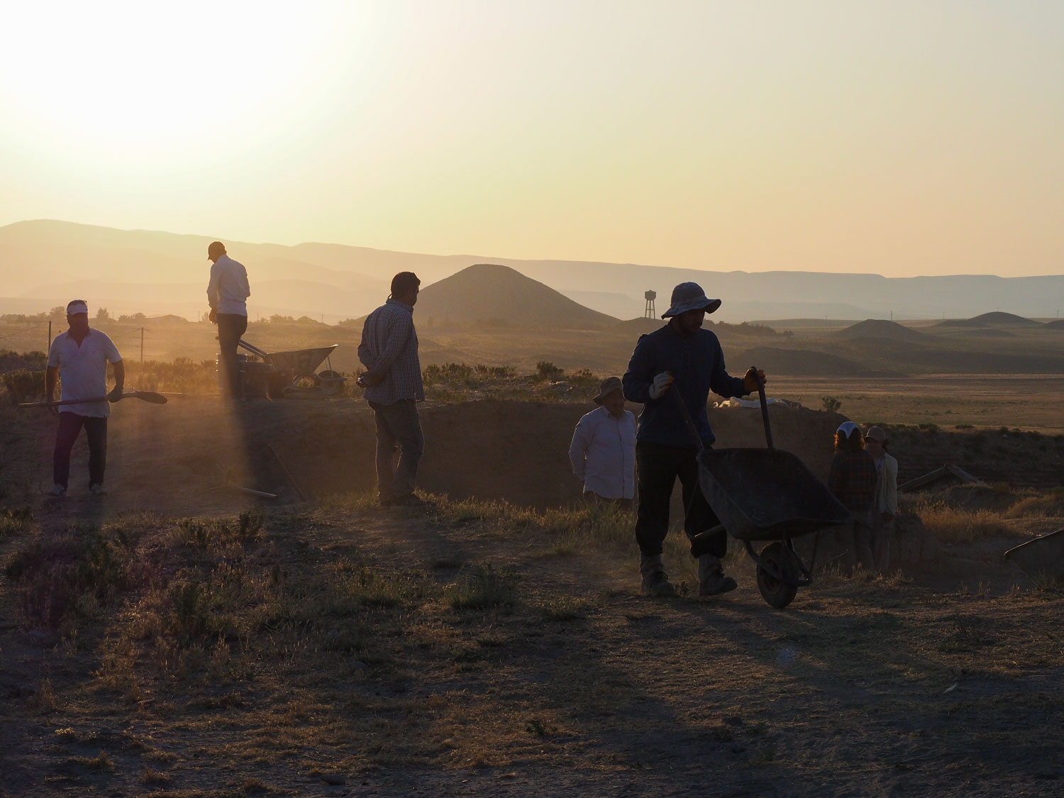
In July 1968, I was directing the Hasanlu Project’s excavation of some tumuli at Se Girdan, situated near the modern village of Cheshme Golin the Ushnu valley of northwest Iran. For several days after the beginning of excavations, workmen pointed to a cluster of trees to the northeast, on the slopes of a mountain that formed the eastern boundary of the Ushnu valley. There, they said, was a very important place, an ancient city, and that the area was called Qalatgah, or place of the fortress. On July 23 one of the local landlords also talked of the site, and he added that there was a road there and that in 1967 local peasants had found a large stone, broken into three pieces, all of which had writing engraved. His description of “stick like” writing suggested that he had seen cuneiform. Yes, he had himself seen the stones and he was able to tell us that one or two pieces had been taken by a local antiquities dealer (who never paid the promised money), who in turn sold the stones to a dealer from Tehran; the third piece was taken to the authorities in Ushnu, the valley’s chief town. He knew the exact place where the stones were found and would be glad to take us there. At last on July 30, I first visited Qalatgah, along with Agha Z. Rahmatian, the representative of the Archaeological Service of Iran, and Carol and Christopher Hamlin, at that time graduate students at the University of Penn­sylvania.

Qalatgah is a large and steep site consisting of several high spots. A few hundred meters up from the modern road, two magnificent springs gush forth from a vertical rock outcrop situated behind a cluster of willow trees. The remains of one or more buildings are still visible on the surface to the north of the springs but we do not know their date. Many thousands of stones litter the site over a wide area, and in at least two places on the slopes to the northeast of the springs are stretches of fortification walls formed of large, well-cut boulders, running east-west. (These walls were the “road” of the landlord.) Further up the steep slope holding the walls, we found a level area at the top and evidence of more walls just protruding from the surface. From this highpoint we could see the whole Ushnu valley and a great part of the Solduz valley to the east, as far as the modern town (and ancient Iron Age tepe) of Nagadeh.

On the eastern slope of the site, not visible from the Ushnu side, there is a large open rectan­gular rock chamber, apparently natural in origin but showing signs of having been worked by man; the open area is now used as a shelter by shep­herds. In his recent article “Urartäische Platze in Iranisch-Azerbaidjan” Wolfram Kleiss reports that at the Urartian site of Kale Waziri, at the north­west corner of Lake Rezaiyeh, there is a “Fels-hole,” an open rock chamber, that was natural in origin but showed signs of human working. Surely these two chambers had similar functions, which may be known to us after Qalatgah’s excavation and more research

Painted triangle ware sherds from (a) Qalatgah, (b) Ziwiye, (c) Hasanlu.

Of the many sherds we picked up over an ex­tensive area of Qalatgah, all appear to be Iron III types (post-9th century B.C.), painted wares with plain or hatched triangles decorating the inner rim of cups and bowls and monochrome plain buff and red-burnished wares, well known from near­by Hasanlu in Period III. Hollow-based bowls, simple, outward curving plain bowls, carinated rim bowls, and cups, are among the shapes rep­resented by the Qalatgah sherds. Similar inner-rim painted triangle decoration has been found at such sites as Hasanlu and at Ziwiye farther to the south­east, and in Urartu at Altintepe, in the final upper level, and in the Van area at Van itself and at nearby Tilke Tepe. The red-burnished wares may also be related to similar types of ware found in several Urartian sites. Moreover, in addition to the painted-triangle ware and red-burnished ware sherds, at home in northwest Iran and Urartu, we also found some very fine, highly polished red-ware sherds known to archaeologists as “Toprak­kale Ware,” so-named after the site in Urartu where they were first found, but since recognized at other Urartian sites, and also recently found by C. Burney at Haftavan Tepe, near Shapur in Iran.

Urartian-seal-Qalatgah
Urartian seal of white stone found on the surface at Qalatgah.

A second trip on August 9th to the site with the whole staff of the Hasanlu Project proved to be more rewarding. Not only did we find more diagnostic sherds of the types just discussed, but I found a white stone stamp-cylinder seal of char­acteristic Urartian type and motif. More impor­tant than this was the find made by Christopher Hamlin: an Urartian inscription on a broken stone block. The stone was found, together with other plain stones, built into a modern dam holding back a pool of water, fed by the two springs of Qalat­gah, and used for local irrigation.

The seal is a concave cylinder, free of dec­oration, with a stylized horned animal running to the right carved at the base; a loop for suspension is at the top. Seals of this type have been called stamp-cylinders by R. D. Barnett, and they have been excavated at Karmir Blur and Toprakkale in Urartu, and at Igydr and Kelankran in the southern Caucasus, made there, no doubt, under Urar­tian influence. I believe the example from Qalatgah is the first from northwest Iran.

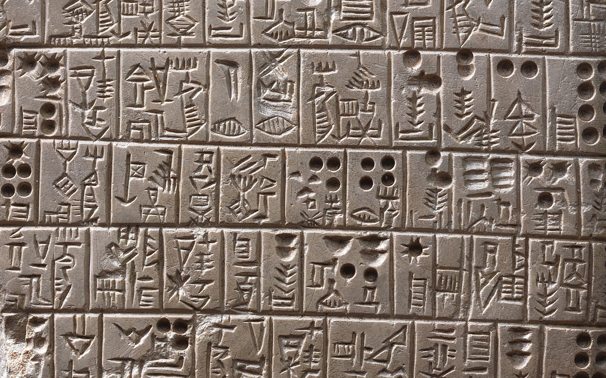
Although they have been handicapped both by the weathering of the stone and by its fragmen­tary state, Christopher Hamlin and Maurits van Loon have been studying the inscription. Van Loon has sent me a preliminary translation which I am quoting here; he will shortly publish a more extensive commentary and discussion in the Jour­nal of Near Eastern Studies:

1)   When, relying upon the god Haldi and upon the god T[eisheba?, Ishpuini,]
2)   son of Sarduri, king of Urartu land Meinua,]
3)   son of Ishpuini, of the country Sapaya
[…]
4)   the king? they too [k? . .] both the god Hal[di and. . .]
5)   for the god Haldi they change[d to hi]s? city Uishe? of the country [. . .]
6)   to the trees of . . . they carried . . .

The text, therefore, had been set up for pub­lic viewing by Ishpuini and his son Menua, some­time during the co-regency of these kings, that is sometime around 810 to 805 B.C. It should also be recalled here that during the co-regency of Ishpuini and Menua they set up an inscription written in both Assyrian and Urartian within the Kel-i Shin pass. That inscription is therefore from the same period as this Qalatgah inscription found in 1968 and published above.

Urartian inscription of kings Ishpuini and Menua, from the surface at Qalatgah.

In the 1969 issue of the Archaologische Mitteilungen aus Iran, J. Friedrich published an incomplete stone inscription found in the Ushnu valley in 1967. Friedrich says the fragment, now in the Tehran Museum, is one of two stones re­covered and that the other is in the hands of an antiquities dealer. I suggest that there can be little doubt that this fragment is one of the inscribed stones reported to me as being found at Qalatgah in 1967, the find-spot of which we were seeking when we began exploring Qalatgah. Whether Friedrich, or his source, or the Cheshmé Göl land­lord who mentioned three stones, is correct, is not presently known. Friedrich’s inscription was written for Menua, son of Ishpuini, and records the erection of a special building as well as a city, not named in the fragment. Therefore, this inscription was set up by Menua after the termination of the co-regency period with his father Ishpuini and is thus to be dated between about 805 and 786 B.C., contemporary with a well-known inscrip­tion set up by Menua at Tash Tepe some fifty miles to the east of Qalatgah. The Tash Tepe inscription mentions the founding of a city in the area (not yet discovered), and is farther southeast than any other inscription of Urartian origin presently known.

The Qalatgah inscriptions—the one found by the Hasanlu Project team, and the one pub­lished by Friedrich—document the historical fact that by the late ninth century B.C. and the earliest years of the eighth century an Urartian city existed in the Ushnu valley, close to the Kel-i Shin pass. The Tash Tepe inscription further establishes that Menua’s penetration into northwest Iran extended east across the Solduz valley and the southern shore of Lake Rezaiyeh. In short, this inscription, taken together with Kleiss’ recent discoveries, en­ables us to state that Iranian territory west and south of the lake was under Urartian control at the beginning of the eighth century B.C.

The pottery found at Qalatgah cannot yet give us exact information about the duration of the site because there is still much work to be done in sorting out the sequences of Iron III pot­tery both in northwest Iran and in Urartu. Kutlu Emre, a Turkish archaeologist, has recently noted that monochrome burnished wares existed throughout the history of Urartian cities, that is in the eighth and seventh centuries B.C. The painted-triangle ware sherds from Qalatgah are the same as those found at Hasanlu IIIB and at Ziwiye. Also, they appear to be very close to, or the same as, the painted pottery from Altintepe in western Urartu, there found only in the upper level, not in the lower where only monochrome pottery was in use. The lower level is dated by the excavator T. Ozguc to the eighth century B.C. (the founder of the city may have been

Arghisti II, about 714-685 B.C.), the upper level to the second half of the seventh century B.C., a date consistent with the terminal dates suggested for Hasanlu 11113 and Ziwiye (new C-14 adjusted dates for the terminal date of Hasanlu 11113 average to 679 B.C. with a half-life of 5730 years). Painted-triangle ware is also reported at Van and nearby Tilke Tepe, as already stated, but the ex­act relationship of this ware to the monochrome ware found at these sites is not clear to me, as it is stated by some archaeologists (including the excavator K. Lake) that the painted ware was in use earlier, during the eighth century, than the monochrome ware, dated there to the seventh century. If true, the situation would be exactly opposite the pottery sequence reported at Altin­tepe. Moreover, at Toprakkale, which is close to Van and Tilke Tepe, monochrome but not painted pottery is found. Toprakkale was ap­parently founded by Rusa II (685-645 B.C.), which if true would mean that painted pottery was not in use there during the seventh century. At Karmir Blur in the northeast, a city also ap­parently founded by Rusa II, monochrome pot­tery is all but universal, painted pottery being rare. Again there is a difference to the pottery sequence reported at Altintepe. Kutlu Emre sug­gested that the present excavations at Van and Patnos may help us understand the relationship of painted and monochrome pottery, and we look forward to published reports on these sites for further clarification of the problem.

In Anatolia, Phrygia, painted pottery was in use during the late eighth century B.C. and con­tinued into the seventh after the Cimmerian in­vasion. In central western Iran at Sialk and in Luristan, painted pottery was in use probably by the late ninth century, almost certainly during the eighth, if, of course, one accepts the pottery of the Sialk B cemetery to be late ninth and eighth cen­tury B.C. in date, or at least eighth century, as I do believe; but the origin of painted pottery in central western Iran is a complex question and need not concern us here.

The site of Qalatgah has not yet been ex­cavated. Nevertheless a few hours of careful surveying, carried out as part of the Hasanlu Project’s goal, to uncover as much information as possible about the history of the Ushnu and Solduz valleys, have turned up some important historical data, hitherto unknown. All we are able to say, and that tentatively, is that it would seem that Qalatgah continued as a site until it was finally destroyed or abandoned sometime during the seventh century, having had an existence of a hundred or more years. The seventh century witnessed major upheavals and movements of peoples in the area, and there were many wars between Assyrians, Scythians, Urartians, and Iranian tribes. Whether Qalatgah remained under Urartian control throughout its history or changed hands is not known to us at present; excavation may make it possible for us to answer the question.

Studies of ancient geography are ventures into the unknown and much difference of opinion exists. All one need do is compare the various maps published by different scholars, each of whom assigns different ancient sites to the same geographical regions. Therefore, it would be pre­mature and dangerous to speculate at present that the ancient city of Qalatgah was built in the land of Barsua, or Manna, or in a Mannean-controlled area such as Uishdish or Subi, states known to us from Assyrian records. At the same time, it would certainly now be incumbent on those concerned with ancient geography to take into account the archaeological evidence of Urartian control over the area west and south of Lake Rezaiyeh in the eighth century B.C. With this thought in mind, I throw out for discussion a tentative suggestion with respect to one aspect of ancient geography that could emerge from our new knowledge about Urartian control in Iran.

The great French scholar Thureau-Dangin published the text of a letter describing Sargon II’s eighth campaign that took the king into Iran, and, according to Thureau-Dangin, into Urartu, before he returned south to sack the Urartian temple site of Musasir, somewhere in northern Iraq. The text mentions the many rivers, moun­tains, cities, and regions passed by Sargon on his campaign. Thureau-Dangin had worked out the route and made a map to illustrate it. His map shows Sargon travelling north around the east shore of Lake Rezaiyeh, then turning west into Urartu where he went around Lake Van before returning south, to Musasir and later home. Sargon’s text does not, however, mention going around any lake, and it has always seemed strange to me that Sargon did not mention Lake Rezaiyeh (a large lake) if in fact he passed by it, especially when his text is quite explicit with regard to geographical features. Sargon also only casually refers to Urartian cities on the shore of a sea, without naming that sea. Thureau-Dangin and most scholars have taken that sea to be Lake Van because, one assumes, of the mention of Urartian cities. But must it be Lake Van? Is it not possible that Sargon never left northwest Iran and that he referred to those Urartian cities we now know existed near Lake Rezaiyeh when he talked of attacking Urartian cities by the sea? If possible, Sargon would then have gone to Musasir from the Lake Rezaiyeh region via one of the several passes existing in the Zagros connecting Iran and Iraq. Indeed there are problems con­nected with this suggestion, one of which con­cerns the use by the Assyrian scribes in several texts of the term “Upper” and “Lower” seas: which term refers to Lake Rezaiyeh? However, the suggestion presented here might be tested by those scholars more knowledgeable than I in matters concerning ancient geography; and if the view presented here about Sargon’s campaign meets with approval, then the ancient geography of northwest Iran will have been altered drasti­cally and we will have to reconsider our opinions about the geographic locations of Parsua, Zamua, and other neighboring states. In any event, an analysis of Sargon’s route during his eighth cam­paign cannot any longer ignore both the absence of any mention of the circling of Lake Rezaiyeh, and the presence of Urartian cities along its southern area, and also west of the lake, as reported by Kleiss.

Cite This Article

Muscarella, Oscar W.. "Qalatgah." Expedition Magazine 13, no. 3-4 (August, 1971): -. Accessed July 01, 2024. https://www.penn.museum/sites/expedition/qalatgah/


This digitized article is presented here as a historical reference and may not reflect the current views of the Penn Museum.

Report problems and issues to digitalmedia@pennmuseum.org.