Tel Masos

Its Importance in Relation to the Settlement of the Tribes of Israel in the Northern Negev.

By: Aharon Kempinski

Originally Published in 1978

View PDF

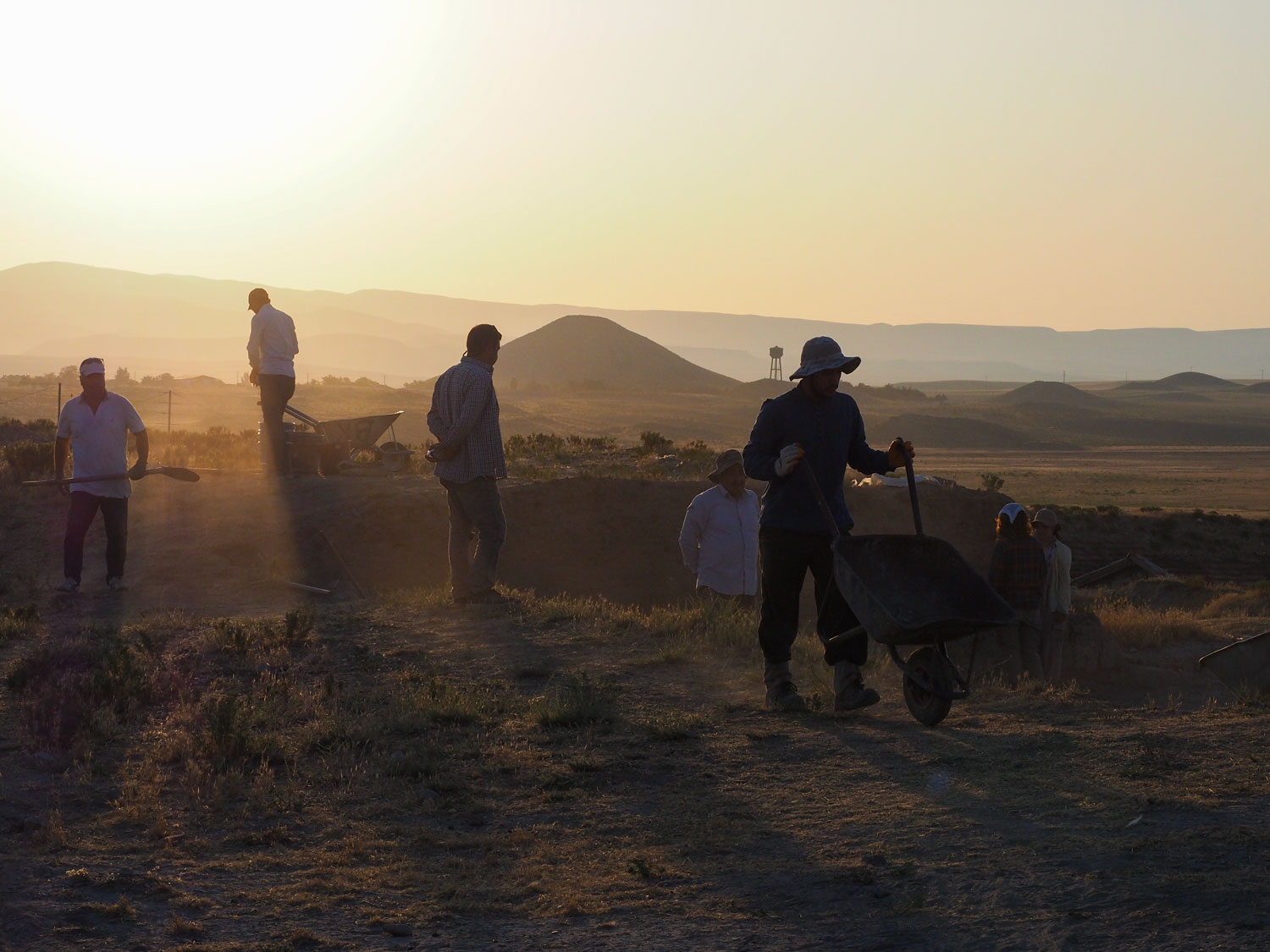
Tel Masos (Arabic Hirbet eI-Meshash) is situated on the edge of Wadi Beer-sheba, approximately 12 km. east of the modern town of Beer-sheba. The site is one of the largest in the Valley of Beer-sheba, and consists of three separate settlements: the main settlement of the Chalcolithic period (ca 3200 B.C.) and Iron Age I (1200-1000 B.C.), which covers about 15 acres; a smaller settlement 100 meters to the west of about 11/4 acres, which includes the remains of a Syrian Nestorian monastery and a caravan­serai of Iron Age II (ca 600 B.C.); and the third area, located 600 meters to the south­west of the main settlement, comprising an enclosure of about 41/4 acres in which remains from the Middle Bronze Age (18th century B.C.) were found. Though it consists of three separate locations, the whole site is known today by the name “Tel Masos.”

The importance of Tel Masos for the understanding of the “Settlement Period” of the Tribes of Israel in Canaan was first recognized by the late Y. Aharoni, while he was conducting surface surveys in the region during the early 1960’s. As a result of these surveys, excavations in the Valley of Beer­sheba were undertaken, including those at Tel Masos. The site was excavated for three seasons, in 1972, 1974 and 1975, under the direction of Y. Aharoni, V. Fritz and the author.

Tel Masos is not a lofty mound contain­ing a multitude of layers from many periods of history, hut a group of single-period sites, scattered around several wells. This concen­tration of settlements indicates the impor­tance of the location in antiquity: here the east-west route passed Wadi Beer-sheba and crossed the north-south path from the Judean hills towards the Central Negev and the Araba.

In the course of time, the crossroads shifted from Tel Masos to Tel Malhata, six km. to the east, and back. An examination and comparison of the periods during which the two sites were occupied, enable us to follow the shifting to and fro of the cross­roads, and to establish the periods during which different road systems were used.

The History of Occupation

The earliest settlement discovered by the excavators in Tel Masos dates from the Late Chalcolithic period. The remains of the period dating from the end of the Chal­colithic and beginning of the Early Bronze Age were found completely covered by the settlement of the Iron Age I period (the period of the Settlement of the Tribes of Israel—ca 1200 B.C.). The Chalcolithic settle­ment is about 15 acres in area. The same Late Chalcolithic/Early Bronze Age period is also found in Tel Malhata, The two settlements formed part of a larger complex of similar settlements along the Wadi Beer-sheba, and one may assume the existence of smaller settlements between these two.

The inhabitants of Tel Masos lived in caves dug in the loess soil. This kind of underground housing was common in the culture of Beer-sheba. One such cave has been excavated in Tel Masos; its pottery assemblage points to the end of the Chal­colithic and the beginning of the transitional phase to the Early Bronze Age.

Six hundred meters to the southwest of the main settlement, the remains of a fortified enclosure from Middle Bronze II were dis­covered. This fort, which protected the route running through Wadi Beer-sheba, was occupied for only a short period in the middle of the 18th century B.C. It stood at one extremity of the chain of settlements of western Wadi Beer-sheba, together with a similar fort in Tel Malhata. The function of the two forts was to protect the end of the route which connected the Shefela (coastal area) with Transjordan. From both Tel Masos and Tel Malhata the route branched off northwards to the Judean hills and Hebron, one of the more important towns in south Canaan at that time. After the middle of the 18th century B.C. the protective function passed from Tel Masos to the fort in Tel Malhata, a conclusion which can be drawn on the basis of the assemblage of stratified pottery: Tel Malhata was occupied from the later part of the 18th to the beginning of the 16th century B.C.

During the entire Late Bronze Age (1600­1200 B.C.) there was no settlement in Tel. Masos or in the neighbouring Tel Malhata, Only at the beginning of the 13th century was intensive settlement activity resumed around the wells of Tel Masos. The first Israelite settlement occupied the same loess hill on which the Chalcolithic/Early Bronze Age I settlement of the late 4th millennium was built. A number of families, probably belong­ing to the tribe of Simeon, settled on the spot, and the old route along Wadi Beer-sheba came back into use.

The settlement built at the beginning of the Israelite Settlement period was abandoned around 980-970 B.C. However, the wells continued to serve the population, which now shifted to TeI ‘Ira, about 3 km. north of Tel Masos. At that time, Tel Malhata served as the junction from which the road branched off to the north. The strata in Tel Malhata form a continuum from the beginning of the 10th century to the end of the Iron Age, at the beginning of the 6th century. In the middle of the 7th century, the wayside station in Tel Masos was revived and a caravanserai was built near the wells. This building activity was connected with the revival by the kings of Judah of a trade and defense system in the Valley of Beersheba. The defenses were directed against the Edomites. However, the Edomite pottery, found in both Tel Masos and Tel Malhata, indicates that some trading was also con­ducted with the Edomites themselves. So far, three ostraka have been found in Tel Masos, all of them containing lists of names of men from the Kingdom of Judah; thus, in addition to trade, some administrative activities were conducted at Tel Masos.

During the Persian period a caravanserai or fort existed at Tel Masos, but it was completely destroyed by later building activi­ties. Pieces of locally produced pottery from this period, and one red-figured Attic sherd, testify to the existence of a settlement during the 4th century B.C.

The last permanent settlement in Tel Masos before the group of wells turned again into a Bedouin center, was a Syrian Nestorian monastery built on the ruins of the Persian fort after the Arab conquest of Palestine in A.D. 632. It is well known that the Omayyad khalifs favored the Nestorians and bestowed various privileges on them. A number of inscriptions in Syriac, as well as the pottery found at the site, make it possible to date the monastery to the end of the 7th and the begin­ning of the 8th century A.D. The monastery served as a stopping place for travelers and may have engaged in missionary activities. A 10th century source mentions that such monasteries were built by Nestorians at crossroads and that their help to travelers was connected with missionary activities.

The fact that, from the Middle Bronze Age onwards, there were periods during which the crossroads at Tel Masos was active and the site occupied, testifies to the exist­ence of a route which some central power or government was interested in maintaining. The longest gap in the occupation of the site was during the Late Bronze Age (1600-1200 B.C.), supporting the view that the road from the Shefela to Transjordan shifted. It ran from west to east, starting from Tel Gerar (Arabic Abu Horeira), going on to Tel Shari`ya, to Tel Halif towards the Judean hills, and from there by way of Devir (Arabic Hirbet Rabud) to Hebron and on to the central part of the mountains towards Jeru­salem and Jericho. We will discuss further below in connection with the process of settlement in Tel Masos, the question of why the route through the Valley of Beer-sheba came back into use at the end of the Late Bronze and the beginning of the Early Iron Age.

Can Tel Masos Be Identified?

Two sites in the Valley of Beer-sheba can be identified with certainty: Beer-sheba and Arad. In Beer-sheba, the old name was maintained throughout the entire Roman-Byzantine period as … and was carried on into Arabic as Bir es-Saba. The excavations in Tel Sheba, about 3 km. east of the modern town of Beer-sheba, showed that a very important fortress stood there at the begin­ning of the Israelite and Judean kingdom. The discovery of an ashlar altar confirmed the use of the site as a central place of worship for the region at the time of the Judean kings.

The second settlement is Tel Arad, which is identified with ancient Arad which served as a fortress during the period of the Judean kingdom as well as during the Persian and Hellenistic periods. The site continued to serve as a fortress in Roman-Byzantine times, and is one of the forts of the Roman limes. The name has been preserved un­changed by the Bedouins in the vicinity for about 12 centuries, ever since the destruction of the last wayside station which still existed in the early Arabic period, During the excava­tions, the identification was confirmed by an offering bowl on which the name of the fortress is inscribed several times.

Tel Masos is situated approximately midway between these two sites and should therefore be identified on the basis of sources relating to either Beer-sheba or to Arad.

Biblical sources often mention a town by the name of Hormah alongside Arad. Hormah belonged to the tribe of Simeon, and is ap­parently the easternmost town of Simeon. In a number of verses in Numbers and Deu­teronomy, a tradition seems to have been preserved which testifies to the attempt of the Tribes of Israel to invade Canaan from the south, climbing from the Valley of Beer­sheba towards the Judean hills. Hormah is mentioned in this context as the main point on the way to the mountains, the very place in which the Israelites were defeated in their attempt to ascend, According to the Biblical historiographer, all of these attempts failed; the one which succeeded was an attack from the opposite direction. In Judges 1 we read:

(16)  And the children of the Kenite, Moses father-in-law, went up out of the city of palm trees with the children of Judah into the wilderness of Judah, which lieth in the south of Arad; and they went and dwelt among the Ama[lekites].

(17)  And Judah went with Simeon his brother and they slew the Canaanites that inhabited Zephat and utterly de­stroyed it. And the name of the city was called Hormah.

Here too, Arad and Hormah are mentioned together.

This passage seems to record an au­thentic tradition concerning the coming of two groups of settlers to the Arad-Hormah region. The first were the Kenites, who came together with people from the tribe of Judah and settled in the midst of the Amalekites; the second group were the Simeonites, who, together with another group of people of Judah, were believed by the author of the Book of Judges to have conquered and de­stroyed an (imaginary?) locality named Zephat and changed its name to Hormah.

Hormah is mentioned for the last time at the beginning of David’s reign when he was ruling in Ziklag as the vassal of the Philis­tines. He sent spoil which he took from the Amalekil es to various towns in the northern Negev and southern Judean hills including Beth-el and Hormah (I Samuel: 26-30). Hormah is not mentioned again in Biblical sources after David’s time.

We saw above that the region of the Tel Masos-Tel Malhata crossroads was the place from which people usually went up to the Judean hills, and we will therefore try to locate Hormah on one of these two sites.

A most important document concerning the history of the Valley of Beer-sheba at the end of the 10th century B.C. is the list of towns in the Negev drawn up by Shenosheq I. The list is very detailed and mentions every small village and fort. The region east of Potis (modern Patish) and Beer-sheba (Hagar Abram = Fort of Abraham! in Shenosheq’s list) up to Arad is well documented, and does not mention Hormah. This is of importance in connection with the question of whether Tel Masos or Tel Malhata should be identified with Hormah. Today the results of the excavations enable us to make the choice. While Tel Masos was settled in the beginning of the 13th century, Tel Malhata was not settled before the beginning of the lath century. In the middle of the 10th century Tel Masos was already abandoned, while Tel Malhata continued to be occupied till the end of Iron Age II in the 6th century. Thus, the absence of the name Hormah in Shenosheq’s list (925 B.C.) corresponds to the abandonment of Tel Masos approximately 50 to 70 years earlier. If Tel Malhata had been the settlement called Hormah, it would be mentioned in the Egyptian list, as it was settled at that time and destroyed by the Egyptian army. Thus Tel Masos can be iden­tified with the Biblical Hormah.

The Stratigraphy and the Most Important Findings in the First Israelite Settlement

Three main strata have been found at the principal mound of Tel Masos. They have been clearly identified in all the excavated areas of the site, and show similar qualities.

Stratum III: The Establishment of the Settlement

This stratum is divided into two phases, III A and III B. The earlier, III B, features cooking pits and baking ovens all over the excavated areas. No trace could be found of buildings of any sort. It seems that this stratum represents the coming of the first Israelites, who chose to settle on the loess hills around the group of wells. The next stage, Stratum III A, features buildings and groups of buildings all over the site. The basic form of building in this stratum is a house which already has the features of the four-room house of Stratum II.

The pottery of these two phases is identical, and must be related to the Canaanite pottery from the end of the Late Bronze Age in the southern Shefela.

The climatic conditions in the Valley of Beer-sheba seem to have been different from those existing today. An analysis of the anima] bones found in Stratum III showed that sheep and goat accounted for only two-thirds of the animal stock, while cattle made up the other third; today, Bedouin farms in the region consist almost entirely of sheep; cattle-herding is rare. The high percentage of cattle shown in the excavations indicates that vegetation was more abundant in the area then than it is now, as otherwise the cattle would not have had sufficient pasture.

On the basis of the ceramic evidence, both phases of Stratum III can be dated to the end of the 13th and the middle of the 12th century. The main indications are the carinated bowls, cooking pots and craters from the end of the Late Bronze Age. Since the Philistines reached Palestine only after 1180 a number of Philistine sherds which were found in the last phase (HI A) of this stratum indicate that the settlement was destroyed after the middle of the 12th century. The date for the beginning of the stratum is corrobo­rated by the discovery of a scarab marked with the name of Seti II (around 1205 B.C.]. It was found on top of the debris of Stratum III, but not in situ.

Stratum II

The builders of Stratum II planned the settlement on a much grander scale than their predecessors. Sometimes they reused remains of old walls from the previous stratum, There is no proof of the existence of a cultural or ethnic gap between the population of the two strata: the focal pottery tradition is carried on, the plans of the houses develop, sometimes based on plans from Stratum III, In area C it seems that the beginnings of the large building (no, 480], built according to the Egyptian-Canaanite plan and techniques, were present in Stratum III, and continued to serve in Stratum II with only minor changes. The same seems to hold true for building no. 419 + 411, but the stratigraphic details are still not completely clear. The abundant pottery finds enable us to date the life span of Stratum II, throughout its two phases, II A and if B, from the middle of the 12th to the middle of the 11th century. Pottery sherds of “Midianite” bowls, similar to those which were found in Timn`a, are the earliest vessels in this stratum. The vessels were dated in Timn`a to the 13th and 12 centuries; it seems that in Tel Masos they should be dated to the beginning of Stratum II—from the middle to the end of the 12th century. Along with the “Midianite” bowls, locally produced vessels were found, but most of the pottery comes from the end of the stratum. A few bichrome and black-on-red imported vessels from the Phoenician coast complete the assemblage.

The settlement of this stratum already shows a conscious attempt at layout. The settlement was destroyed either by an enemy attack or by an earthquake.

Stratum I

The remains of Stratum I which lay open for three millennia were almost completely washed away by erosion. From the little that remained, one can discern the following changes: in area C, a fort appeared on top of public buildings nos. 480 and 411. It faced the wells and served as the “strong tower” into which the inhabitants fled in case of a nomad attack. The erection of this fort marked a deterioration in the security situation in the Valley of Beersheba, and the beginning of a process which ended in about 950 B.C. with the building of fortified cities all along the valley.

Most of the houses built on top of the ruins of Stratum II show the four-room plan. There is no evidence that the settlement was encircled by a protective belt of houses as was the case in Stratum II (see below, p. 35). It seems that the “strong tower” sufficed for protection.

The pottery finds point to the destruction of the settlement at the beginning of the 10th century, possibly around 990-980, the beginning of David’s reign in Jerusalem. At that time the Simeonite Negev was being neglected, and was attached to the territory of Judah.

After the destruction of the settlement in Tel Masos, its inhabitants moved to the neighbouring Tel ‘Ira (Biblical Ramoth Negev? —Joshua 19:8) 3 km. to the north, and joined its population. Tel ‘Ira was occupied during the entire Iron Age, and was one of the larger sites in the northern Negev.

Tel Masos at its Peak

Stratum II is the main stratum in Tel Masos, the settlement reaching its peak during its life span. It is also the best excavated, and enables us to observe for the first time the way in which an important settlement was planned and built during the 12th and 11th centuries B.C.

The principal guideline for the builders in Stratum II was the idea of enclosing the center of the settlement by a belt of buildings on the edge of the hill. By joining the outer houses together a defense belt evolved. This method of fortification arose from early forms of defense. It is also found in nomadic camps, which tend to be encircled by a chain of tents, protecting the center of the camp. The Israelite settlers may have used the same type of camp structure while they were still in their semi-nomadic state before settling in Tel Masos. Indeed, in Stratum HI some features indicate that the fringe of the settle­ment may have been encircled by a belt of this kind.

The defense belt has been well identified in area A. We can discern the main details of the construction: the belt of buildings stretches along the outskirts of the settlement; the outer court of each house is defended on both sides by its neighbouring houses. In area A the belt is interrupted by a public building which is also flanked on both sides by protruding structures which project towards the slope of the hill, and thus defend the building’s outer courtyard. The thick walls, and the remains of a staircase podium on its west side, indicate that the building had several stories and may have served as a local fort to which the people fled when threatened by danger.

This kind of defense was precarious and could withstand only attacks from small groups of nomads. Since the doors of the houses opened onto the outside of the settle­ment, a stronger attack could easily break in through these openings. At that period, no attempts to seriously fortify the settlement in the manner used during Iron Age II are discernible. After the year 1000, however, new defense structures developed: the four-room houses were built facing inward so that their backs served as a casemate wall for the whole settlement.

The basic building unit of Stratum II is the four-room house. It contains three storage or living rooms which surround an open inner courtyard, This plan evolved from the three-and two-room houses in Stratum III which seem, in turn, to have originated from the basic plan of the tent or hut used by the semi-nomadic Israelite population before their settlement. The tent, similar to the contemporary Bedouin tent, consisted of a room open on its broad side towards an outer court.

The four-room house of Stratum II is similar in its main lines to the typical Israelite house which served both the urban and rural population throughout Iron Age IL Those found in Tel Masos are the earliest known examples of this type of house, and represent well documented evidence of the process of development of this type of dwelling from the semi-nomadic to final settlement.

In area C a complex of public buildings formed the main entrance. In areas B and F the defense belt of houses runs toward this public complex, encircling the whole settle­ment. In area C we discern the continuation of the planning principle of the Canaanite town from the Late Bronze Age: the main public buildings are concentrated near the main entrance into the settlement.

The buildings in the public complex are interesting in themselves; they seem out of place in such a rural settlement. To the west df the settlement entrance stands a fort-like construction (building no. 411] which features a large courtyard. This courtyard is joined on its west side by a small fort or tower with decorative offsets. Parts of the fort are built according to the building techniques used in Egypt and the southern Shefela: brick walls built on a brick basement, without a stone base. The decorations of the outer walls also point to influences from Egypt and the south­ern Shefela. Next to this fort, another building was unearthed (building no. 480). It is 15 x 15 meters in size and has an Egyptian-Canaanite plan, very much like building no. 1500 in Beth Shan. On the east side of the entrance to the settlement a building with elongated rooms was found, possibly a storage building.

This complex of public buildings may have had its beginning in Stratum III dating from the first half of the 12th century during the period of Egyptian rule over southern Canaan. At that time, during the reigns of Rameses III, Rameses V and Rameses VI, the way through the Valley of Beer-sheba regained its importance for both trade and military purposes. It is also possible that the whole complex was built by the Philistine rulers, who inherited parts of the Egyptian administrative apparatus in south Canaan after 1150 B.C. In any event, the construction of such a highly developed complex of public buildings near the main entrance testifies to the existence of a central government which took the trouble to develop the settlement, thereby imposing on it its own architectural style. This style, however, appeared only in the public buildings; the private houses continued to be built according to the local four-room plan.

In the center of the settlement only a few buildings have been uncovered; perhaps rela­tively large empty spaces were left there. In the central area, H, two adjoining buildings were found in one of which a room for ritual purposes containing rich finds from the whole life span of Stratum H were revealed. Stone figurines which might stem from the semi-nomadic period, luxury vessels from the Phoenician coast, “Midianite” howls from the southern Araba, and an ivory head of a lion from the coastal region all came to light. These objects, together with the copper im­plements that were found, testify to the wide range of commercial ties which Tell Masos enjoyed from the southern Araba to the coastal region to the north, and to Phoenicia. The opinion that Tel Masos was an important center of the copper trade is supported by the chemical analysis of the copper artifacts found here: most of the ore is from the mines of Fenan and Timn`a. In areas A and C proof that copper was worked on the spot was found: in area C a crucible was discovered and in area A a workshop with some remains of ore.

The settlement was not confined to the inside of the circle formed by the defense belt: houses were found spread out as far as 300 meters away from the defense chain. One of them (no. 1000) was excavated and found to belong to the Stratum H period. This means that the fortified settlement served only as a nucleus for a wider, scat­tered settlement. It could well be that part of the population even retained its former semi-nomadic way of life in the vicinity of Tel Masos.

Tel Masos and the Israelite “Settlement Period”

The excavations in Tel Masos further our understanding of the settlement process of the Southern tribes (the Simeonites, Hova­ vites, Yerachmielites, Kalebites and others), and, indirectly, the general process of settle­ment in all parts of Canaan.

The main question that arises is: why did the settlement wave sweep into the region of the Valley of Beer-sheba precisely at the end of the 13th century B.C.? There is only a partial answer, We may assume that the region of the southern Judean hills grad­ually became overpopulated, partly because of natural increase, partly because of the arrival of new immigrants from Transjordan (the tribes of Judah and Kaleb?). This region was classic ground for a semi-nomadic way of life in the Late Bronze Age, and the Canaanite urban settlements were restricted to areas that lay along the one main route through the Judean hills. With the growth of the semi-nomadic population, the food supply in the area was no longer sufficient, and some groups descended from the mountains into the fertile Valley of Beer-sheba. At that time the valley was more humid than it is today, and richer in vegetation.

The existence of various tribes and clans in the mountainous area, some of them old inhabitants and some newcomers—the latter presumably more aggressive—caused a serious deterioration in the security situation along the main international route through the Judean hills towards Jericho. The trade caravans could no longer count on safe transit. Thus, while part of the semi-nomadic population was descending to the valley, the main trade route shifted to the same area, creating more opportunities for the new valley settlers. So it was that the road which had been abandoned in the 17th century at the end of the Middle Bronze Age again came into use at the end of the Late Bronze Age in the 13th century.

Cite This Article

Kempinski, Aharon. "Tel Masos." Expedition Magazine 20, no. 4 (July, 1978): -. Accessed July 05, 2024. https://www.penn.museum/sites/expedition/tel-masos/


This digitized article is presented here as a historical reference and may not reflect the current views of the Penn Museum.

Report problems and issues to digitalmedia@pennmuseum.org.