Image Number: 47794
Those who had an interest in history or archaeology realized to some extent its great strategic value in the constant struggle for the control of the great highway between the east and west, which passed through the Valley of Armageddon. Its identification as the Bethshean of the Old Testament and as the Scythopolis of the Hellenistic and Roman epochs has never been in question, but beyond the briefest mentions in our only available sources, there was no material on which to base any real estimate of its great antiquity, or the part it played in history. Most visitors too, have given the place a bad name. Its people were said to be knaves and thieves, its climate most deadly and the heat insufferable. Enough indeed, to deter anyone from attempting more than a brief sojourn on the spot. So Beisan remained for many years rather neglected and ignored. About fifty years ago, when there arose an enthusiastic interest in the history of the Holy Land, with a consequent demand for systematic research on its sites, Beisan had passed into the hands of the sultan Abdul Hamid as his private property. This effectually prevented the possibility of any effort being made to master its secrets by extensive excavations. Happily, after the war, the new mandatory government immediately declared all antiquity sites state domain and made them available for scientific investigation.
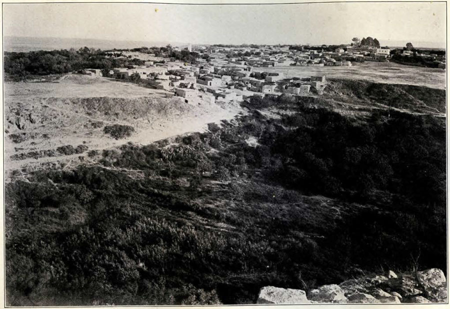
Image Number: 41805
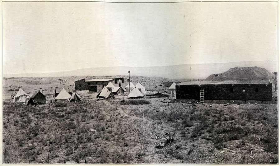
As to the above mentioned physical discomforts, the expedition of the University Museum after three long seasons of work at Beisan has proved that the dangers could easily be guarded against,and that it was quite practicable to carry on excavations during the heat of the summer, which is in fact the only season when digging can be done at all. For us the old difficulties, especially its private ownership, have turned out to be decided blessings. They kept the main site from occupation by houses or being used for a Moslem sacred tomb or cemetery, conditions which interfere with the full investigation of most historical sites in Palestine. True, portions of the hill have been the quarries for the stones used in the walls and streets of the modern town, but this has only partially destroyed the topmost stratum and left undamaged the more important ruins beneath.
The excavation of the entire extent covered by the city in the Roman and Byzantine periods would be a formidable undertaking, and for the present our researches are confined to the mound called Tel el Husn and the cemetery extending along the northern bank of the Jalûd. The mound or tel not only represented the great acropolis of the later periods, but also comprised within its limits the whole of the walled area of the Canaanite city. From a test trench on the eastern side it was soon discovered that we had to deal with many superimposed strata, extending from an Arab settlement on the top, of about 800 A.D., down to a mud brick structure containing the characteristic ledge handled jars of the Early Bronze Age, at least 2000 B.C. At this point we had reached a depth of thirty-six feet with no sign of the rock.
To trace satisfactorily the development of such a site, it is necessary to remove one by one the various strata, uncovering each as a whole, and after mapping the details of the rooms and
their contents, proceed to remove it and reveal the stratum next below. In this manner we had by the end of the third season taken twenty to thirty feet off the height of the hill and uncovered eight distinct building periods, reaching a brick fortress dating from the reign of Seti I (1313-1292 B.C.). Going down through the floor of one of the chambers of this building, another three feet disclosed the massive walls of a similar structure with a slightly different orientation.
In an old well near the center, which was cleared to a depth of forty feet below the fortress floor, again without rock being reached, ware visible the ends of a succession of mud brick and rubble walls. From this evidence we may reasonably conclude that the further exploration of Beisan will give us a fairly complete sequence of strata dating back at least as early as 3000 B.C., and in all probability beginning with the first neolithic settlement on the rocky eminence which formed the nucleus of the present great mass of debris.
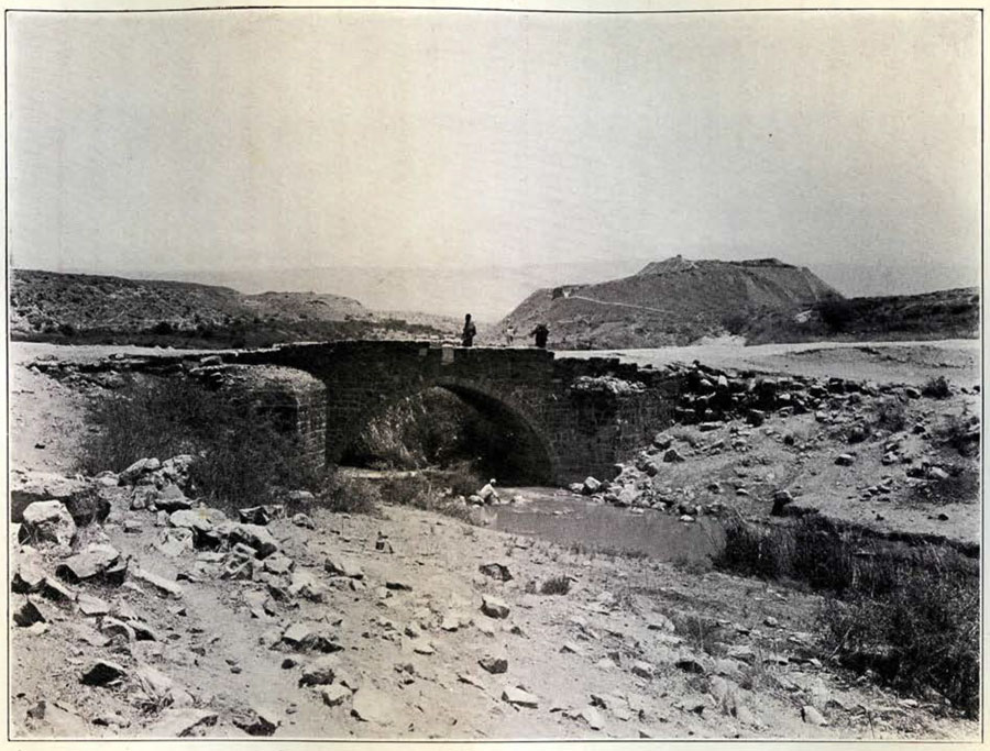
Image Number: 41803
The Egyptian fortress had a fairly regular plan, with groups of small chambers and long corridors surrounding open courts. The walls, which in some places still stood to a height of nearly ten feet, were built with large bricks of sun-dried clay 21 x 14 x 6 inches in size. These were laid in mud mortar and the faces of the walls finished with a fine mixture of clay and lime. The floors had a thick coating of cement laid over a bed of rubble. From one corridor, just north of what appeared to be the main court, a brick staircase led either to the roof or to an upper story. The main entrance was near the northwest corner, and while here, unfortunately, the plan of the building had been cut to pieces by later foundations, the great sill was still in situ with portions of the two jambs, all of carefully dressed and fitted blocks of basalt which dovetailed into the brick masonry of the main walls on either side. The northern portion of the fortress was given over to store rooms, and in several of these were large quantities of fragments of pithoi for the storage of oils and grain.
West of the main court was a hall in which were commemorative stelae of Seti I and Rameses II, together with a seated statue of Rameses III, all of local basalt. The stelæ had fallen forward on their faces one across the other, but below them were their two bases in place. The statue was at the east end of the hall nearly opposite the Seti stela. During the first season another stela of Seti I had been found lying in the debris five feet above the floor of the fortress and seven feet to the south of the new stelæ. This had evidently formed a part of the same group, but had been removed and re-used as a door sill. Its rounded top, with most of the offering scene was missing, and the text so badly worn that scarcely two thirds of it was legible. It gave the names of several of the local tribes whom Seti had overcome, probably during the later campaigns of his reign. The new Seti stela had been erected in a shallow niche at the western end of the hall. Although broken in three pieces in its fall, it was in perfect condition, with characters and reliefs deeply and clearly cut. The top panel showed Seti as a young man wearing only the short skirt and the uraeus headdress, making an offering to Horus. The text, after long preliminary formulæ, gave a brief description of a local campaign in the first year of Seti’s reign (1313 B.C.). One day a messenger came to him from the chief of Bethshean requesting aid against the “vile one” of Hamath, who had formed a league with the men of Pella, a city just across the Jordan from Bethshean. Already they had shut up the chief of Rehob in his city, which lay a few miles to the south and was one of the “sister” cities of Bethshean. Seti, at the time of the receipt of this appeal had probably already reached Megiddo in his first campaign into Palestine and Syria. Here at the western end of the Valley of Jezreel he was resting his forces before continuing his advance northwards into the land of the Hittites. Appreciating the opportunity which this local disturbance gave him, he at once put part of his army in motion, sending two divisions eastward down the valley. The division of Ra was sent to occupy Bethshean itself, and that of Amen to take active operation against Hamath. At the same time the division of Sutekh was sent northwest into the southern foothills of the Lebanon to Yenoam. This last movement, far out of the main action, may be explained by the necessity of making a demonstration against the Hittites while his main army was engaged eastward. The Egyptians had never yet come into conflict with the Hittites and Seti would scarcely leave his flank exposed to a sudden counter raid by an enemy who well knew the object of his campaign. The Ptah division, if we assume that Seti had with him the same four divisions which later were employed by his son Rameses II in the battle of Kadesh, was not mentioned in our text, and probably remained behind to hold Megiddo and the road to Egypt. The last line of the stela stated that the conflict was finished “in one day” with a complete victory for Seti.
The name of Bethshean occurred twice in the text and its spelling established the fact that it is the city mentioned in the El Amarna correspondence. Further excavation therefore should reveal remains of its occupation by Thothmes III, some 130 years earlier. During the weakening of Egypt’s foreign policy, during the latter days of the XVIIIth Dynasty, the fortress had passed out of Egyptian control, but the local inhabitants evidently retained some memories of the prowess of Egyptian arms and called upon them for assistance in the time of need. In any event, Seti, by his victory, brought this stronghold back into Egyptian hands and he then fortified it anew, to be used as a center from which he could conduct his further campaign against the lands beyond Jordan.
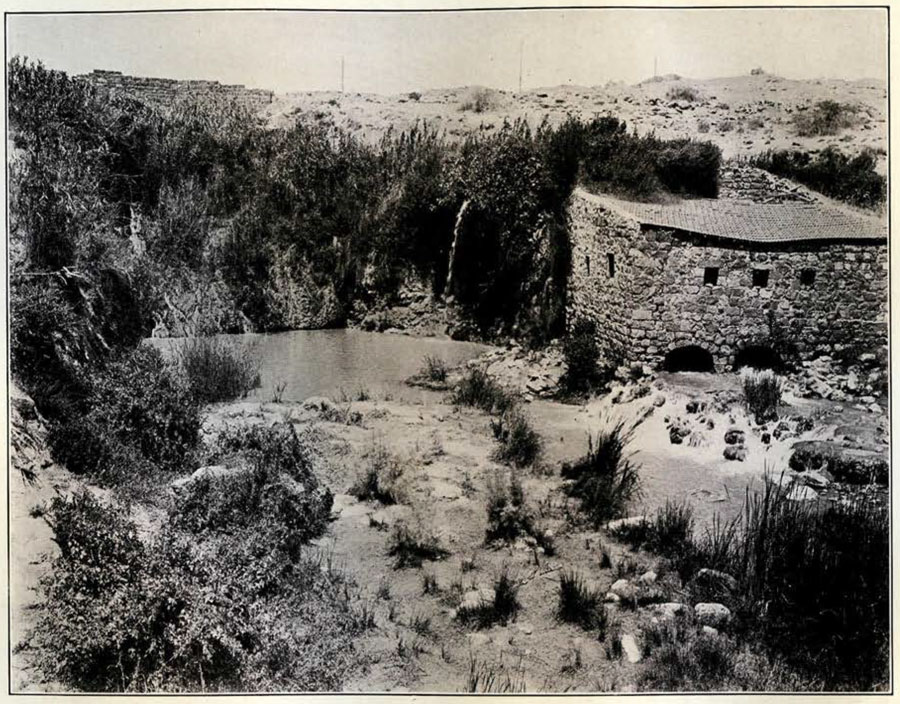
Image Number: 41800
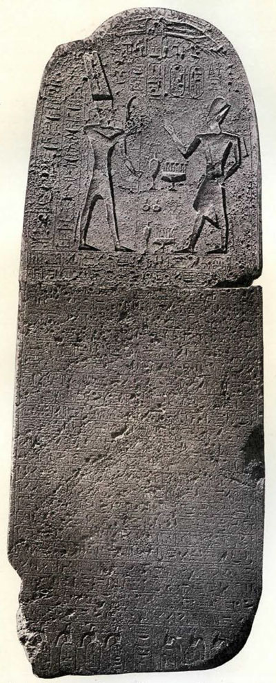
The stela of Rameses II was erected beside that of his father, and to make room for it, a portion of the end wall was cut away. It was slightly larger than the other stela and the stone not of such even quality, several porous veins marring its surface. The hieroglyphics were neither so deeply nor so carefully cut, but the text, except for a few words, was quite legible. It consisted of twenty-four lines wholly devoted to an exposition of the might of the king, who was “like a lion among the goats”, “an eagle among birds”, his enemies “flying like feathers before the strong wind”, the sort of eulogy which Rameses II was so fond of inscribing on his records. It will rank as a masterpiece of poetic literature, but we cannot help wishing for our own selfish interests, Rameses had realized that his fame would rest more securely upon a detailed record of his conquests. However, quite casually tucked away in the midst of all this flowery language, was one short line of immense importance to us; a simple statement that Rameses used Semites in the building of his name city in the Delta. Have we not here at last that long sought for confirmation of the Biblical record of the labor of the Children of Israel in the Land of Egypt, when they were forced under task masters to “build for Pharaoh store cities, Pithom and Rameses”? This would definitely establish Rameses IT as the Pharaoh of the Oppression, an old identification that has persisted in spite of weighty opposition.
The stela also mentions that Rameses prepared a splendid burial place for his soldiers. It is tempting to link this statement with our cemetery at Bethshean. During our second season we uncovered a strip of the extensive northern necropolis, and amongst tombs ranging in date from about 2000 B.C. down to the Byzantine era, were a number of unique terracotta sarcophagi. These were found in or dragged just outside of roughly rounded rock chambers. They were cigar shaped, and each had near the wider end, a detachable cover on which was modelled in relief a human head. Those for women were naturalistic and their large wigs suggested Egyptian influence. The male faces were, on the other hand, always grotesque with prominent noses, pierced ears and no beards. That they were chiefs of some rank was attested by the various ornamental headdresses. Furthermore, some of the objects found with these burials were distinctly Egyptian in character, such as necklaces with pend-ants of lotus buds, uraeii and apes, and the end of a large bronze uas sceptre. But there were also saucer lamps and a few pieces of imported Mediterranean pottery. These sarcophagi could be dated roughly from 1200 to 1000 B.C., and were clearly the sepulchres of some body of foreigners having close affiliation with Egypt. A natural conclusion is that they were mercenaries whom we know formed part of the Egyptian army as early as the reign of Rameses II.
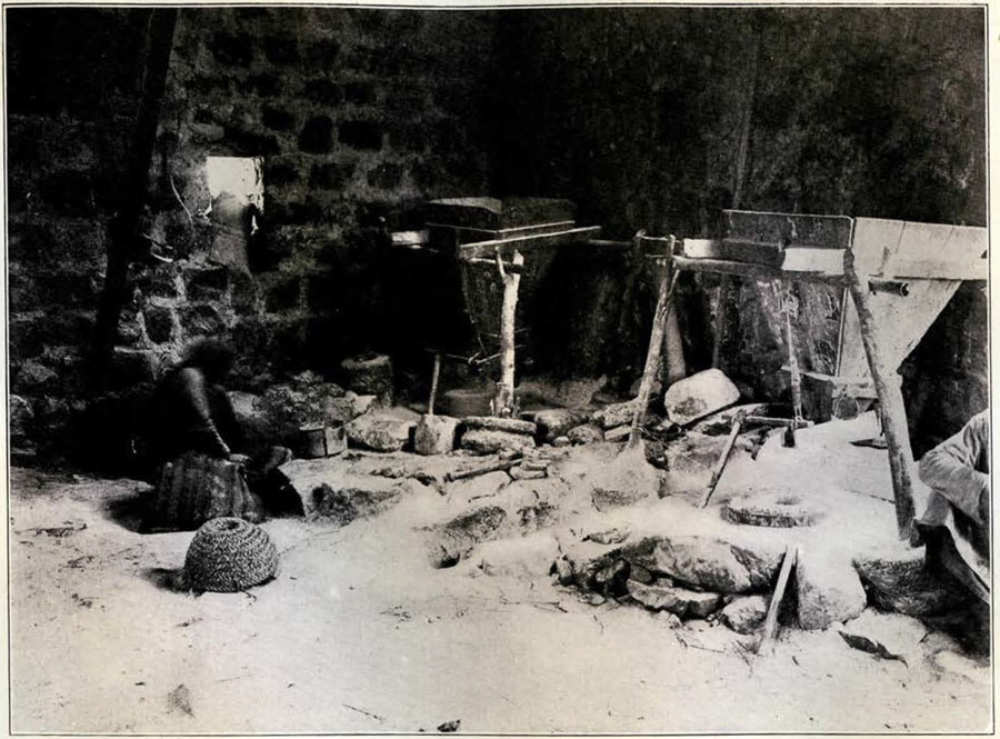
Image Number: 41799
The statue of Rameses III was broken in two at the waist and the upper portion lay on the ground nearby. On each shoulder was a cartouche of the king, but the statue was otherwise uninscribed. The modelling was somewhat coarse and evidently the work of a local craftsman.
To complete the list of Egyptian monuments, we must not neglect to mention the fragment of another large basalt stela which was found re-used in the foundations of the Byzantine church. It had the finer technique of the second Seti stela, but not enough has yet been found to enable it to be identified.
This group of dated records found in situ, is sufficient proof that the town had remained in Egyptian hands practically from 1313 to 1167 B.C. Towards the close of this period Egyptian domination in Palestine was again on the wane and her old enemies, the Hittites, were likewise giving way before the inroad of the new power, the Philistines, who were slowly sweeping down from the north through Syria; destined to play another great role in the military drama of the Holy Land.
In the comparatively short period between the close of Rameses III’s reign and the advent of the Children of Israel upon the scene, the city passed into Philistine hands. The remainder of the old garrison, receiving small encouragement from their alien neighbors, were glad to place the key to the valley in the hands of the new invader, and none the less eagerly because large numbers of their own countrymen were in the ranks of the Philistines. The latter were already firmly in possession of the fortress when the Israelites began to apportion the lands to the north and south between the different tribes, and were already too powerful to be dislodged. They were fully able to cope with Saul and his Israelite army, when he came against them, and inflict upon them that memorable defeat upon the slopes of the nearby Mount Gilboa, and then, as a last sign of their contempt for their opponents, hang the bodies of the king and his sons upon the walls of Bethshean.
We have the clearest archaeological evidence that up to this time the fortress remained unchanged, as some of the pottery from the rooms was as late in date as the end of the second millennium B.C., proving that the original structure was in use until this time. Shortly after, however, as we discovered, the entire building was destroyed by a great conflagration. This disaster gives us another good working date, as it can scarcely be doubted that it was caused by King David about 1000 B.C.
David, it will be remembered, when the messenger brought to him the news of Saul’s untimely end, laid a heavy curse upon the scene of the disaster. We have every reason to believe that David, once he had firmly established himself on his throne, took the earliest opportunity to avenge the disgrace to Israel and remove such a menace to his people’s occupancy of the Promised Land. He organized a campaign against Bethshean, and took the impregnable citadel by a sudden and vigorous assault, in much the same way as he secured possession of the city of the Jebusites for his capital. In the days of Solomon, his successor, the city was subject to tribute. The sack of the citadel was thorough. Everywhere the mud brick walls were baked red in the terrific heat; especially in the northern portion where the oils and grain in the storerooms supplied abundant fuel for the flames. Here the bricks from the falling walls and the beams from the roof had filled corridors and rooms to a depth of over three feet with a mass of debris burned as hard as rock and as difficult to remove.
Never again did Bethshean, as a fortress, threaten the neighbourhood. For the ensuing 800 years its history was very uneventful. In all that period only one thing kept the once mighty town from complete desolation. In and over the ruined fortress walls were found the ruins of another occupation; a group of small houses crowded together without system or regularity, with here and there circular bins for storing grain and ovens for baking bread. This insignificant village is our only evidence for the existence of a settlement said to have been established here by the Scythians in their great sweep through the country during the VIIth century B.C. The presence of the descendants of these settlers nearly 300 years later, probably suggested to the Greeks the name Scythopolis which they gave to the place. The curtain however had been rung down on the glories of the old Semitic Bethshean and when it rose again, it was to disclose a new city developing rapidly under a very different civilization. It was destined to surpass its ancestor in wealth, beauty, culture and influence, but its stimulating factors were not to be arrogance and militarism, but peaceful commerce and religion.
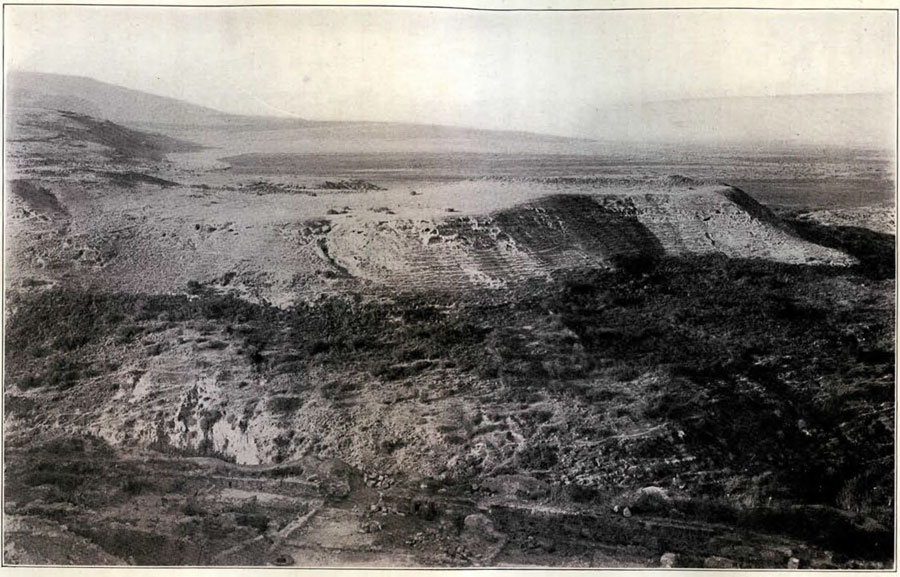
Image Number: 41801
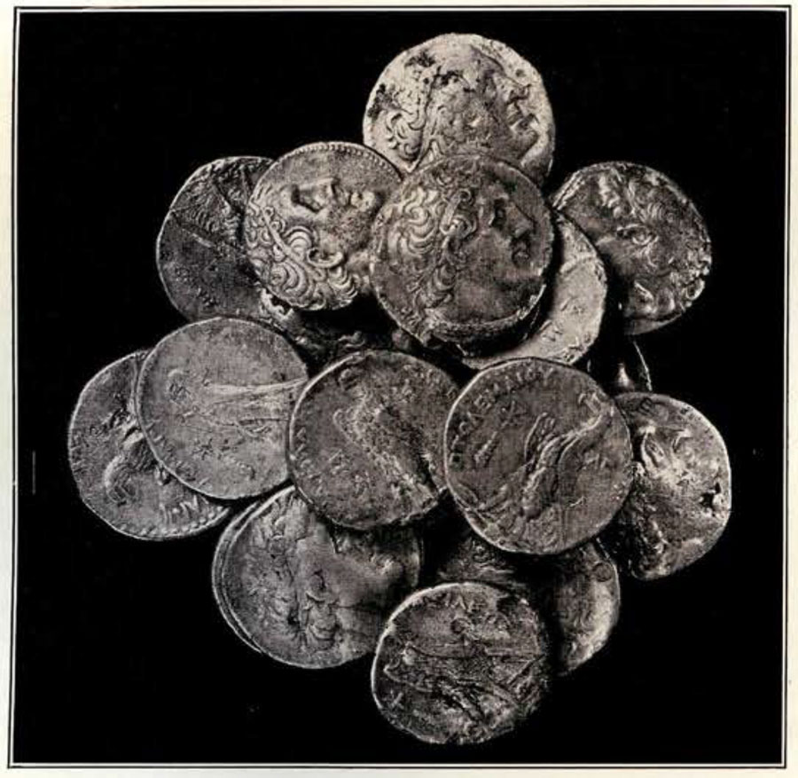
The earliest evidences of the renaissance of the city were portions of a great temple crowning the summit. Two fragments of columns belonging to this bore finely cut inscriptions with the name Demetrius. In one of the rooms just south of the temple and on the same stratum, was found a hoard of silver coins all of Ptolemy Soter I. These help us to identify the builder with Demetrius I, surnamed Polyorcetes, King of Macedonia from 294 to 287 B.C. For some reason the building was never completed until the Roman era. Only a small portion of the foundation walls at the west end are preserved, together with a number of drums from the columns and fragments of the entablature. The columns were 51 inches in diameter, with well modelled Attic bases and Corinthian capitals, all local limestone. Much of the detail clearly belonged to the Roman period. A garlanded head of Bacchus from the frieze suggested that the temple, at least in the later period, was dedicated to that deity. This inference was further supported by several fine terracotta figurines of Bacchus nursed by nymphs, found in the cemetery. Classical writers associated the name Nysa, the birthplace of Bacchus, with Scythopolis, and many of its coins bearing that name are known, so that the presence of a great temple of Bacchus here is not unexpected. Either inside the temple or just in front of it stood a gigantic white marble statue of Bacchus or some Roman emperor. This must have been at least 25 feet in height. Only two gigantic toes and a finger joint have been found at various parts of the summit, and no doubt the major portion of the figure had long since been used for making lime. Fragments of a beautiful mosaic floor were found near the western portico, with tiny accurately fitted tesserae of graded colors. Unfortunately, we can obtain no idea of the complete plan of the temple, but a tentative restoration of its height can be made from the drums and fragments.
Again, owing to its splendid position at the junction of the several highways leading to the cities east of the Jordan, and to its wealth accruing from the well watered region surrounding it, Scythopolis became the metropolis of the cities comprising the Decapolis. With the advent of Christianity we have mention of it as a city of magnificent churches and monasteries. Its clerical population, however, were noted neither for their great sanctity nor their morals.
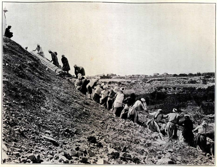
Image Number: 41781
The first church built on the summit was erected early in the IVth century A.D. To make room for it, the pagan temple was razed and most of its masonry broken up for use in the new building. The church was of the prevailing basilica plan, with a central nave and aisles. It occupied nearly the whole summit, its east, south and western walls being still in situ, with traces of the apse at the east and a great vestibule at the west. It was approached by a stone paved roadway winding up the western terrace from the gate at the northwest corner of the hill. The vestibule, and some of the rooms on either side of the apse were paved with alternate red and white marble squares, laid diagonally, but in the southern aisle was a small much damaged fragment of fine mosaic. Another small room, adjoining the north end of the vestibule, had its mosaic pavement almost intact. Just outside the north of the apse was a large tomb chamber built below the floor, and this, from its special position, may have been the tomb of St. Patrophilus, the first recorded bishop of the city. During the anti-Christian riots in the year 361 A.D. the church was pillaged and burned by a mob. The tomb of the saint is said to have been desecrated and his skull hung up as a lamp. The marble slabs, decorated with crosses and wreaths, enclosing the altar, were broken up and thrown over the outer walls of the summit enclosure into the houses of the lower terraces. Here were found part of the loot from the church consisting of several bronze frames for lamps, two bronze lion headed knockers from one of the doors, and fragments of hinges, bolts and other hardware.
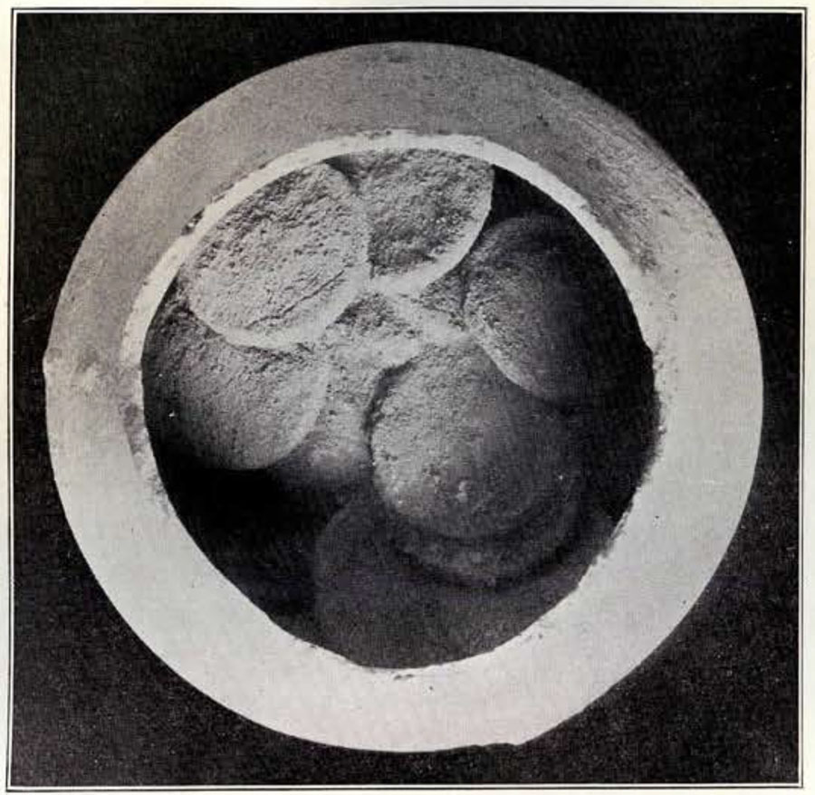
When the church came to be rebuilt, a radical change was made in its plan. While the outer form of the building was retained, a large central rotundo took the place of the previous nave. In laying this out between the walls of the old narthex and apse, the architects did not succeed in making it a perfect circle, so that part of the curve, adjoining the narthex, is flattened. That this was not wholly an error, however, seems to be shown by the fact that the two circular walls of this new feature were built so as to include between them, without injuring it, the old tomb of the saint. The rotundo was about 125 feet in diameter and consisted of a central area surrounded by a colonnade. The foundation walls for both the outer wall and the colonnade were intact. In the enclosing wall, four doors, approximately between the four cardinal points, but not symmetrically spaced, led to chambers at the corners. The central area had a pavement of white marble in large blocks, and most of the colonnade was floored with smaller squares of colored marble laid diagonally, except inside the western door where there was a mosaic of simple squares and crosses. The eight columns of the colonnade were of verde-antico, with Attic bases and Corinthian capitals of white marble. The walls were faced to an unknown height with marble in panels, and above this must have been pictures in colored mosaic on a gold ground, as quantities of both gold and delicately tinted glass tesserae were found all over the ruins. A dome, open at the top, covered the rotundo and a water conduit was constructed around the edge of the colonnade to conduct the rain water to a huge reservoir just outside the south wall.
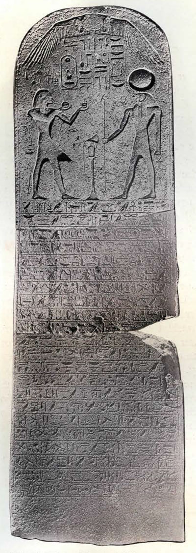
Image Number: 30121
In 637 A.D. the city fell into the hands of the Saracens. They, in the early Moslem fashion, turned the church into a mosque, but beyond scratching a few of their names in Cufic on the marble floor, they did no injury to the edifice. The mosque must have been partially damaged by one of the earthquakes in 658 or 713 A.D. as the marble floor was relaid subsequently, but in the process the Cufic inscriptions became disarranged.
Later, we find the plan of the building wholly obliterated by the regularly laid out street and walls of an Arab town. This occurred before 784 A.D., since, in this year, a visitor wrote a long Cufic inscription on one of the columns where it lay prostrate at one side of a new roadway.
The ancient name of the town had survived amongst the natives and with the advent of the Moslems it came again into universal use in the form Beisan. The new Arab town was enclosed by a well built wall, utilizing the old gate at the northwest corner as a sole entrance. Within this enclosure the town was divided into two parts, the lower embracing the terraces on the west, north and east sides of the hill. Here were small houses along narrow lanes. In many cases the older Byzantine walls were adapted to the new needs and the stratification was much confused. The summit had its own enclosing wall, forming a platform, with a second or inner entrance on the west from the lower area. This became the headquarters of the Arab administration. From the inner gate, a straight street ran east and west dividing the platform into two nearly equal parts. The commandant occupied a fine regularly built house with a court. One small apartment was set aside for prayer, with a stuccoed niche in the wall towards Mecca. The remaining houses were more regular, and in plan followed largely the old foundation walls of the Byzantine period.
During the siege by the Saracens in 637 A.D. the inhabitants, as an additional measure of defense, cut the dykes which controlled the abundant and numerous streams on the plain west of the town, permitting the water to spread over the fields. When the Arabs entered into possession of the place, they apparently made no effort to repair the damage and gradually a vast pestilential swamp took the place of the rich lands. Thus a new enemy was introduced which played a more fatal and decisive part in its subsequent history than any human element. For this reason the Arab town never grew to any importance. When the Crusaders conquered the district, they recognized the importance of the hill for defensive purposes. They erected along the southern edge of the summit a temporary dwelling place or barracks. This contained on the ground floor a refectory, with bakery and store rooms attached, and on the floors above, reached by a double staircase, a dormitory. A great fortress was projected, but of this only the foundations of the northwest corner were ever completed. The unhealthy condition of the neighborhood soon had its effect and the Crusaders were compelled to abandon Beisan as a base and select the summit of a hill some miles to the north as the site for a fortress, which they called Belvoir. Some force was maintained at Beisan and the poorly fortified town resisted the assaults of Saladin in 1186 A.D., but the town fell into his hands the following year. Belvoir held out for a year and a half longer, the last great stand of the Crusaders in the Holy Land. While the abandonment of Beisan was a grave tactical mistake, since it left the main gate open, it was caused not by the stupidity of the Christian commanders, but the irresistible forces of nature fighting against them, causing them to change their plans and thus sealing their fate.
Beisan now finally dropped from notice. Slowly but surely malaria decimated its population until it became a mere group of tiny hovels, inhabitated by an enervated people, a mixture of every race, without the skill or incentive to cultivate properly their crops and forced to turn for a living to nefarious practices. At the present time, scientific projects are under way to drain the marshes and restore a vast area to the cultivation of grain, flax and fruits. The caravan routes crossing the Jordan by the old practicable fords, still pass through the town and one sees in the proper season long lines of camels, with their pleasantly jingling bells, passing along the roads laden with the produce of the countries beyond the river. With the necessary elements of peace, health, energetic labor and good government, Beisan may once more climb to its deserved height as the great city at the eastern end of the Valley of Jezreel.
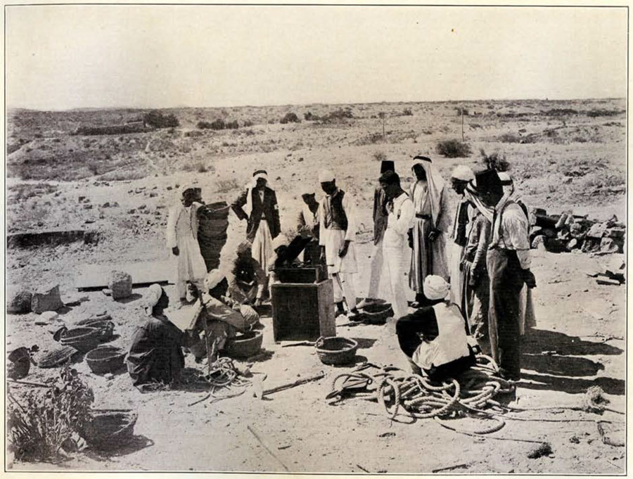
Image Number: 41797