TEXAS, although the largest state in the Union, has been quite neglected by archæologists and therefore was chosen as the field of operations for one of the summer expeditions of the University Museum. The reason for this neglect is readily comprehensible: despite its size, Texas contains no ruins or archæological remains of outstanding interest. To the west lies New Mexico with its cliff houses and modern inhabited pueblos, the Mecca alike of archæologists and of Fred-Harveyized tourists. To the east are Louisiana and Arkansas with their burial mounds of former Indian peoples which afford pottery vessels of esthetic value. And across the Rio Grande to the south, although far to the south, lie the great ruins of Old Mexico, the work of the Aztec, Toltec, Maya, and the other great civilizations of America. Small wonder, then, that Texas has been a neglected orphan, with but a few of her native sons to take any interest in her remote past.
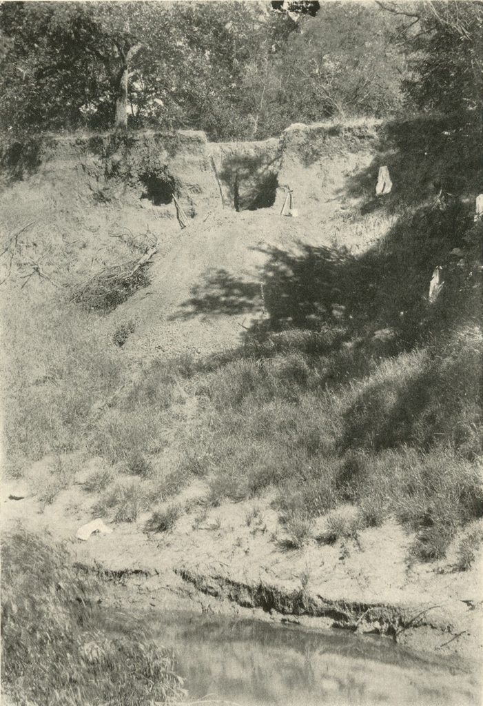
Image Number: 24249
Yet such peripheral and intermediate regions as Texas are of great importance in archæological science, and only by their investigation can the true relationships of the higher cultures on either side be determined. When carefully investigated, Texas may be found to hold the key to many important problems concerning the relationships of the Mexican, the Pueblo, the Plains and the Southeastern Indian cultures. It was in the hope of shedding some slight light on these problems that several months were spent in this region this summer by the Museum Expedition.
The personnel consisted of Mr. Linton Satterthwaite, Mr. Charles Bache and myself ; during the first few weeks we were also accompanied by Mr. E. B. Howard, and by Dr. Frederick Oldach of the Department of Geology of the University.
On July 22 the expedition arrived in Floydada, a small town in the southern Panhandle region of Texas, and there established its first headquarters. It was in the height of summer and the scorching dry winds swept across the plains like blasts from a furnace. Mr. W. M. Massie, resident agent for Mr. Howard’s ranch in that vicinity, rendered us constant and valuable aid, for which we must express our great appreciation. This part of Texas is on the Staked Plains, the Llanos Estacados of the Spanish, to us a monotonous expanse of perfectly flat and absolutely treeless prairie, but to the agriculturally minded natives a “fine country” Until a decade or two ago it was unfenced cattle lands, ridden by cowboys, but today it consists of interminable fields of cotton, intersected by straight roads which require no grading.
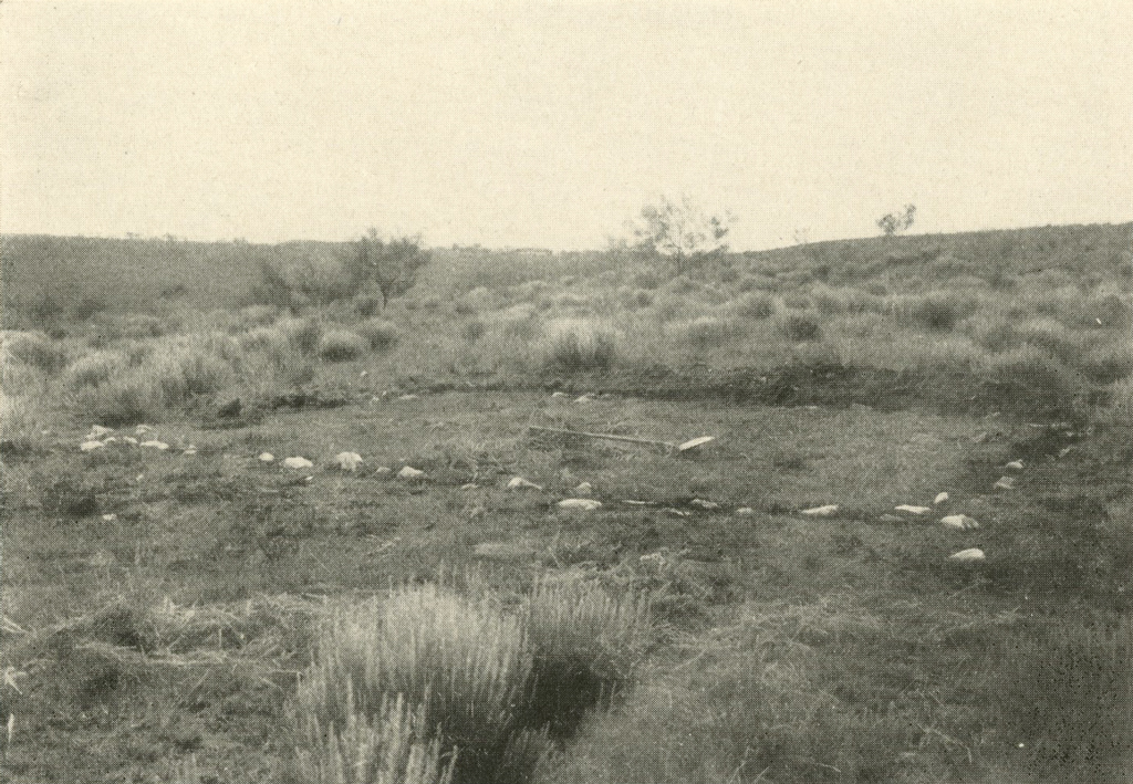
Image Numbers: 24310, 24311
Only a few days were spent around Floydada, for absolutely no information could be obtained concerning sites of Indian occupation. Some there must be, but unfortunately no one in this region takes any interest in archæology, and the sites in central Texas are so few and so unimpressive that, without information from interested residents, it would require many days of search to locate one. The same situation exists over all Texas, and is true of most regions throughout America. In one town one or two men with antiquarian interests will know of a score of sites within fifty miles, while in the next town everyone questioned will insist that the region is utterly bare and that one should go to Pecos, to Pueblo Bonito, or to some other far-away place of which he has read in the newspapers.
So three days later, after purchasing a used Chevrolet truck which we christened Amaryllis, after Amarillo, the metropolis of the Texas Panhandle, we left Floydada, and arrived that night at the city of Lubbock. In this part of Texas even the national interstate highways are rarely paved, but except during and just after rains they are kept in comparatively good condition by frequent scraping. The making and upkeep, however, of even these few and poor roads must be a great problem to the state, as the mileage is great and the population very sparse.
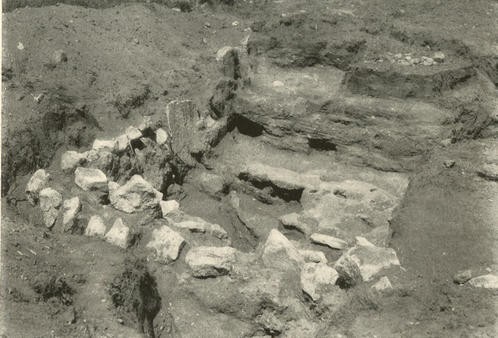
Image Number: 24312
At Lubbock we were welcomed by Dr. Holden of the West Texas Technological College and viewed the archæological collections which he has inaugurated there, but as he has resided in that district only a short time we were unable to learn of any sites in the vicinity and proceeded to Abilene. Although Abilene is probably no richer archæologically than most sections of Texas, it is the headquarters of the Texas Archæological Society, owing to the residence there of a small group of enthusiastic archæologists, led by Dr. Cyrus N. Ray and Mr. E. B. Sayles. Dr. Ray took us to, or directed us to, many sites on which we made small collections of arrowheads, scrapers and similar artifacts. The culture here is rather rude and certainly of the type of the plains. Fragments of pottery and artifacts of smoothed stone are exceedingly rare, but there seems to have been some differentiation either of tribal or of temporal occupation, for the artifacts from all sites and the situation of these sites are not uniform, but are distinguished by the local archæologists by such terms as “sand dune sites” and “small scraper sites.”
On the banks of the Clear Fork of the Brazos River north of the town of Albany Dr. Ray had excavated two skeletons which he described in the Scientific American last spring. They were excavated from the cut-bank of the river, some thirty feet above present water level and about six feet beneath the surface. The soil above appears to be undisturbed and stratified. These remains have not yet been examined by expert anthropologists, but Dr. Ray believes them to be unusual in some respects and of great age. Since the problem seemed an important one, the first piece of extensive archæological work was begun here by the expedition. A cook was engaged, camp pitched, and excavations made from July 30 until August 3. Instead of digging in from the bank as Dr. Ray had done, a pit was sunk from the surface a few feet from the site of his find. The soil was extremely hard baked and the temperature terrific, so that it took the combined efforts of the five of us to dig carefully a pit eight feet square and deep during this period. The soil was almost certainly naturally deposited, stratified and undisturbed. At the depth of about four feet a rude arrowhead was unearthed, at six feet several scrapers, and at eight feet, just as the work was being abandoned because of the obviously undisturbed and sterile nature of the earth, a piece of bone three or four inches in diameter was uncovered. It was apparently a fragment of a human cranium, probably somewhat mineralized and presumably of considerable age, obviously deposited there by natural means and not buried. The bone still awaits examination by a somatologist. I fear it is too small to allow exact determination regarding the physical type or archaic characteristics of the individual. The degree of mineralization may afford some data on its age, but both the rate of this process and that of the deposition of the overlying soil vary so greatly with natural conditions that it is to be feared that they will permit no definite determination.
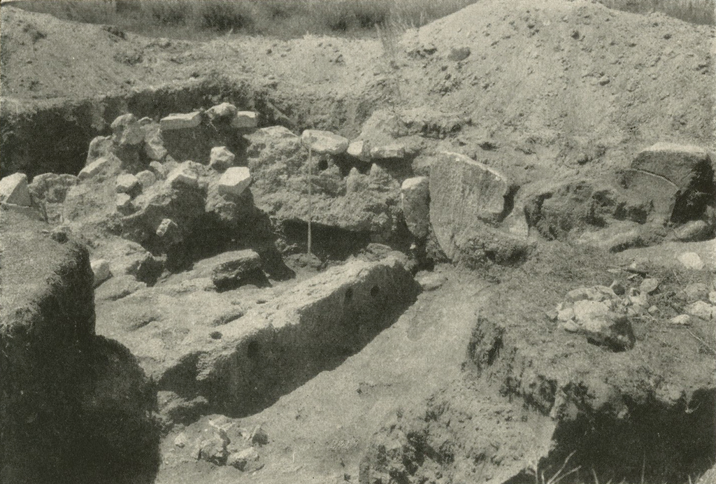
Image Number: 24313
From Abilene we turned north again. Stopping for a day near the town of Rotan, we excavated a grave to which we were conducted by Mr. Louis Miller of Rotan and Mr. James Latham, a ranchman with antiquarian interests. The skeleton was found, but it was much dessicated and fragile and accompanied by no objects, obviously a burial of a member of one of the groups of plains Indians. Proceeding through Floydada again, where Mr. Howard and Dr. Oldach left us to pursue geological investigations, we drove north to Amarillo.
About forty miles north of Amarillo is the Canadian River, the largest stream in northern Texas. It is also the only river which, flowing eastward to the Mississippi, rises in the mountains of northeastern New Mexico. Certain of its headwaters, especially the Mora River, rise near the headwaters of the Pecos and close to the present pueblo of Taos. It would thus be expected to be the route of intercourse and trade between the inhabitants of the pueblos and those of the plains. That it was actually used for this purpose is indicated by the discovery, on the slopes of the bare hills lining Palo Duro Creek fifteen miles south of Amarillo, of small bits of pottery representing most, if not all, of the types of pottery found at the ancient pueblo of Pecos near Santa Fé. This pueblo has for fifteen years been undergoing excavation by the Department of American Archæology of Phillips Academy, Andover, Massachusetts, under the direction of Dr. A. V. Kidder. That the former habitants of Pecos journeyed so far east is thus established, but since no ruins of pueblo type are found in this region, it seems most probable that these potsherds represent merely temporary camps of the Pecos people while on expeditions to hunt bison. Close to this site is the town of Canyon, the seat of the West Texas Teachers College, where Mr. J. E. Haley has established a small museum of history, archæology and natural history.

Image Number: 24289
Around Amarillo, as everywhere throughout this region, are also found the camp sites of the nomadic Indians who occupied this country at the time of the historic occupation. These camp sites yield artifacts in the form of chipped and flaked flint, arrowheads, spearheads, scrapers, knives, and fragments of pottery, though the latter are of a type different from and ruder than the pottery of the pueblos. Artifacts of smooth stone are practically unknown, but grindstones known as “metates,” which resemble somewhat the stones for grinding corn used by the agricultural Indians to the west, and the hand mullers or “manos” which were used on them, are common. It is not certain whether these tribes actually cultivated a little corn, or whether the metates were employed for grinding seeds or other natural products. At any rate, their use probably indicates a cultural influence from the pueblos to the west.
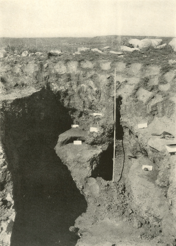
Image Number: 24294
But along the Canadian and especially on the short creeks which flow into that river are found the houses of a people whose culture was apparently restricted to this region; they seem not to be found east or west of the Texas Panhandle. This culture seems to have been a blend of pueblo and plains elements, and deserving of more attention than has heretofore been paid it. A decade ago Mr. W. K. Moorehead of Phillips Academy, Andover, made some surveys through this region, but his reports have not yet been published. One of these groups of houses on Wolf Creek, known as Handley’s Ruins, has been given some publicity in the public press, but no careful report on any has ever been published.1 The investigation of this culture, therefore, was one of the principal objects of the Museum’s expedition.
Mr. Floyd V. Studer of Amarillo gave most freely of his time and aid to the expedition, and to him the Museum is deeply indebted. Among other places, he conducted us to a site on Alibates Creek, north of Amarillo, where we made camp in a deserted ranch house and worked from August 9 until August 19. On one of the hills overlooking the broad low valley of the Canadian are dozens of rings and a few rectangles made of stones, laid flat or placed on edge. These probably represent the walls of semi-subterranean houses, the superstructures now fallen in and the rooms filled with soil. A few artifacts were picked up on the surface. On an adjacent hill are a few more similar sites which were chosen as the expedition’s scene of labour. Three sites were partially excavated, a small round ring, a large rectangle and a small hillock with many stones placed on edge. The former revealed nothing of importance. The rectangular site was partly excavated by Mr. Satterthwaite, with help from Mr. Bache. It was outlined by a rectangle of stones, mainly placed on edge, which were found for the greater part to be embedded in a hard material made, apparently, of a lime cement. The flooring was of the same material, but the arrangement was too unusual and intricate to be here detailed.
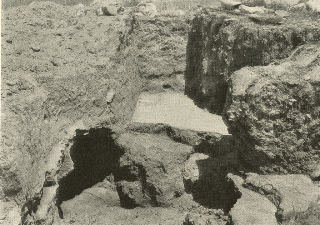
Image Number: 24301
The site partially excavated by myself and Mr. Bache was of different type. It had already been dug into by some oil-field employees who had run a pipe line across the hills, by Mr. Studer, and by Dr. R. L. Olson of the American Museum of Natural History, New York City, who this summer preceded us in visits to many places. On one side of the hillock a room had been partially excavated, the walls of which were marked in places by long vertical stones of natural shape embedded in the walls, visible for a few inches above the soil and extending as far as two feet below the surface. This room was not further excavated. On the other slope of the mound another room which had been partly excavated was continued until the important features were determined.
The room measured about fifteen feet in diameter and was mainly rectangular, though one corner was rounded and one side may have been curved. Built in the side of a mound, the upper floor was at the ground level on the lower side of the mound, but about four feet below the surface at the crest. The underground walls were of adobe or mud, but were solid and not built of adobe bricks as in the modern Mexican style. Most of them were blackened by smoke. Although the walls were not very much harder than the material which had filled the abandoned room, the fill broke away from the walls with a clear cleavage. In this room no stones were set into the tops of the walls as was the usual practice. A number of different floor levels were noted, the lowest being two or three feet beneath the uppermost. These floors were apparently made of hard packed clay or mud over which was laid a thin film of plaster. In the centre of the house on the uppermost floor level was a rather deep conical depression with a few large stones and a large quantity of packed ash in it, undoubtedly the fireplace. Similar fireplaces would doubtless be found in the lower and earlier floors, but for the greater part the upper floor was left intact and was broken through to the bottom in only one place. The area of the fireplace was marked by a depression of probably six inches in the floor which dropped in a rather abrupt curb with rounded edges. At four points at equal distances from the fireplace were holes in the floor, which details showed plainly represented the posts which upheld the roof. Above most of the floors were found charred beams turned to charcoal, clay burned to brick bearing the imprint of small poles or reeds, and carbonized grass.
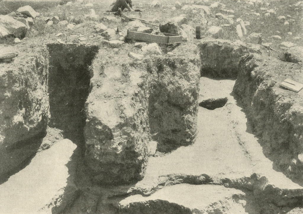
Image Number: 24308
The deductions from these data are evident. The house consisted of a room partially underground, the walls and floors made of clay faced with plaster. The roof, which rose to an unknown height above the surface, was supported on four posts placed in the interior of the room and consisted of cross poles with a straw thatch above this and possibly a covering of mud. The walls above ground may have been of the same construction as the roof or of solid adobe. The inflammable nature of the building led to frequent conflagrations during which the roof was destroyed and fell to the floor, partially filling the room. Instead of cleaning the debris out to the level of the original floor, it was packed down, leveled off, and a new and higher floor made upon it.
Very few objects of any value were encountered in these excavations. Flaked flint implements were in the majority, most of these made of a banded red and white flint which is peculiar to this region and a few specimens of which, determined by him to be of extraneous origin, were found by Dr. Kidder during his excavations at Pecos. A very few potsherds were found and one small ornament of shell but no artifacts of smoothed stone. Some bits of the larger and better preserved carbonized beams were saved in the by no means optimistic hope that the age of them might be determined by a study of the annual rings, a system which has been developed in recent years by Dr. Douglass of the University of Arizona and which promises eventually to afford an accurate time scale for American archæology. In this same room Mr. Studer excavated what appears to be a piece of carbonized matting.
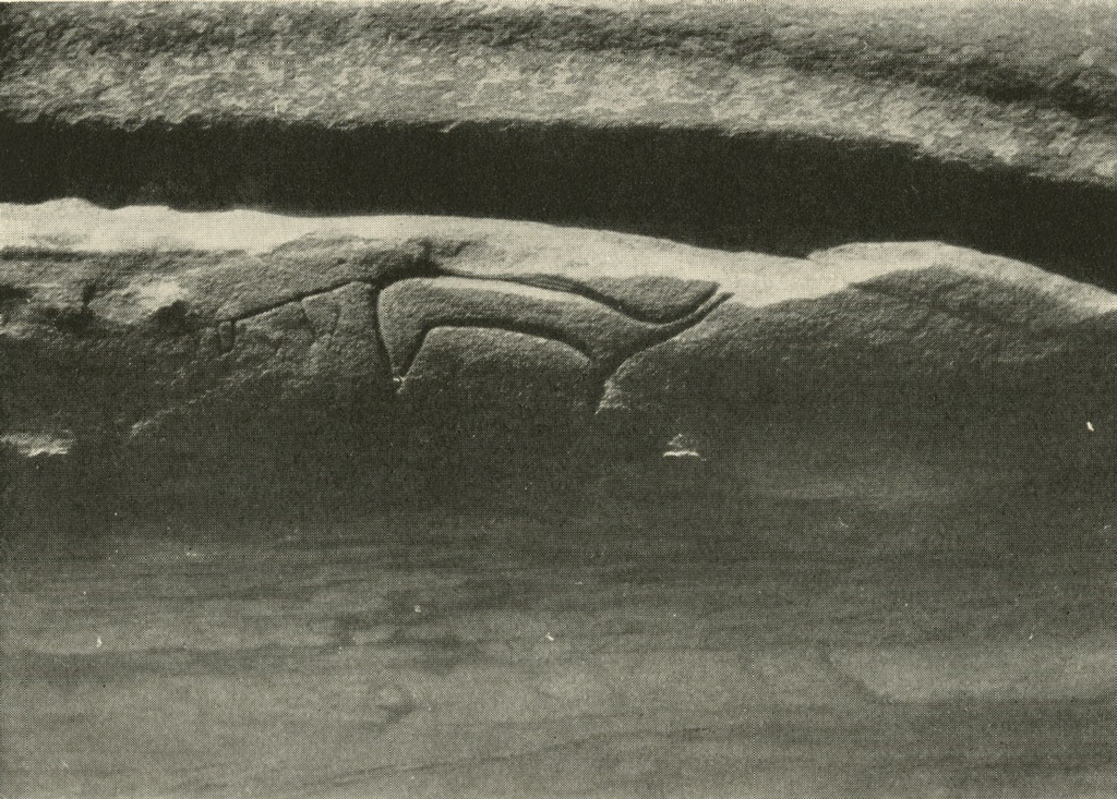
Image Number: 24274
All of these artifacts, including the pottery, resemble those of the Plains Culture far more than those of the Pueblo. But the architecture is strikingly Pueblan on the whole, resembling decidedly that of the semi-subterranean rooms of the Post-Basket-Maker or Pre-Pueblo peoples. The culture is therefore probably a hybrid and intermediate one and deserves more attention than has hitherto been paid it.
Another site of this same culture was observed further to the west on the Canadian and to the north of the town of Vega. Here are a large number of house sites crowded together on the top of a steep-sided mesa, obviously for protection. They may therefore be of a period subsequent to the building of those on Alibates Creek, which are open to easy attack. On the slopes of this mesa are pockets in which were found quantities of animal bones, refuse from the houses above, and on the slopes and at the bottom of the mesa quantities of pottery fragments were picked up.
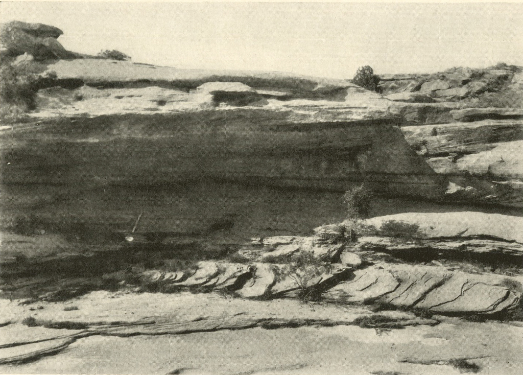
Image Number: 24271
We were due to attend the conference of archæologists at the pueblo of Pecos on August 23 and so returned to Amarillo and motored west towards New Mexico. The greater part of one day was spent on Grape Vine Creek, north of Adrian, Texas, where a cave or great overhanging rock shelter contains many pictographs. Some of these are incised in the rock and some painted in red and black colours. These were photographed, drawn and rubbed. Most of the figures represent animals and human beings, the largest and most impressive one being apparently of a horned serpent, done in black and red. While my impression is that the incised petroglyphs are older than the painted ones, this may not be a valid conclusion.
Amaryllis, despite four flat tires in twenty miles, brought us into Pecos in time for the conference, which was attended by most of the anthropologists then in the West and which lasted for three days. Then a pleasant week-end was spent in picturesque Santa Fé. On the way to Las Vegas we visited Tecolote, a Pre-Pueblo site excavated this summer by the archæological students of the Anthropological Laboratory at Santa Fé, and there made a small collection of potsherds.
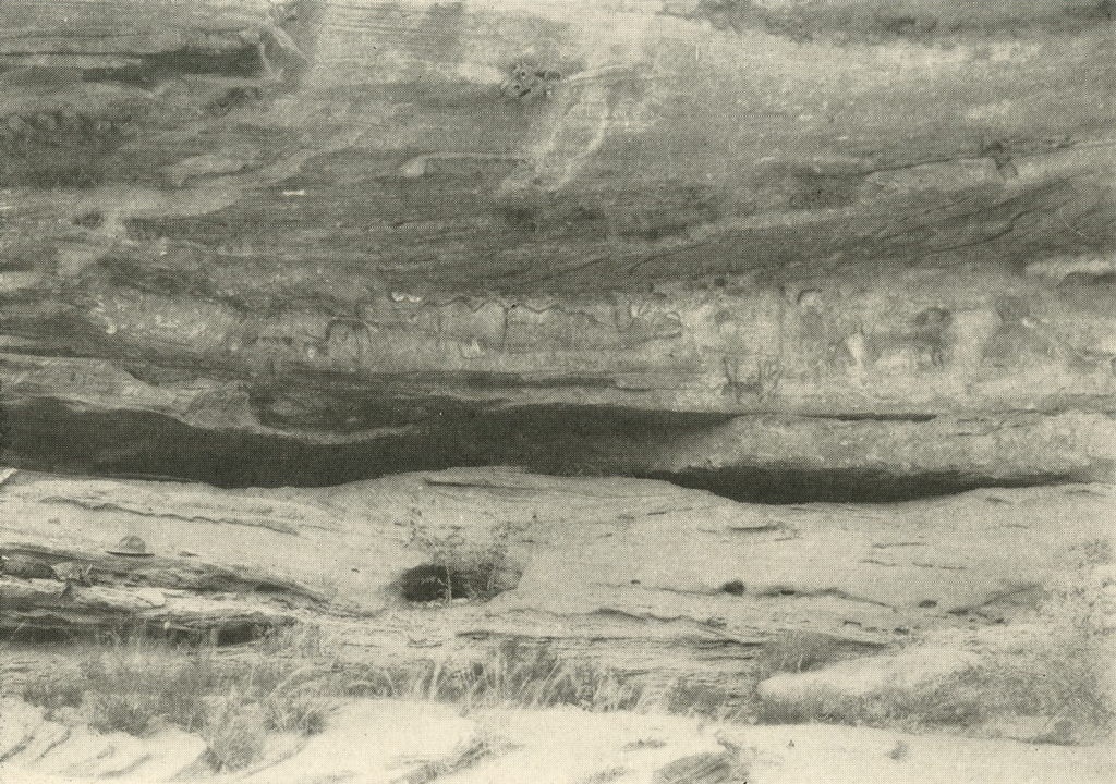
Image Number: 24276
It was our intention to spend considerable time on the Mora River, the largest affluent of the Canadian in New Mexico, with the hope of finding there some ruins of the Texas type. We proceeded first, therefore, to the town of Mora near the headwaters of this stream, a delightful old out-of-the-way New Mexican town where Spanish is heard far more than English. It is hardly possible that there can be no Indian ruins in this fertile valley, but none was known to the residents and we returned to Watrous, a small town at the confluence of the Mora River and Sapello Creek. Here Mr. Reynolds gave us kind assistance and showed us some mounds on the bank of the Mora on which potsherds are frequently found. Although it was not our intention to work upon sites of pueblo culture, we could not resist a few days’ work here and so excavated from August 29 until September 7. In architecture the site somewhat resembled that on the Canadian, the underground walls and floors being made of adobe mud, but less smooth and finished. However, instead of enclosing single rooms, the walls were partitions between rooms, and the group on the mound excavated consisted of a dozen or more. The same superposition of floors was noted and the same charred beams and lumps of fire-baked clay with the impression of poles or reeds. The latter were unusually frequent, the charred beams rare. In contradistinction to the Texas site, potsherds were common and flaked implements very rare; the country evidently did not produce much flint. The pottery was of unmistakable Pueblo type, mainly black corrugated ware but with a fair quantity of painted black on white and a few pieces of black on red.
A site of somewhat different construction was visited upon the top of a mesa known as Loma Parda, a secluded New Mexican village not far from Watrous. Here were found the lower courses of what were apparently low walls of piled stone. An excellent metate and several perfectly shaped manos were secured here but no excavation was done. Near the mouth of Sapello Creek we were shown rocks covered with incised pictographs which we photographed and drew. They resembled considerably those seen on Grape Vine Creek in Texas and probably were made by the same people.
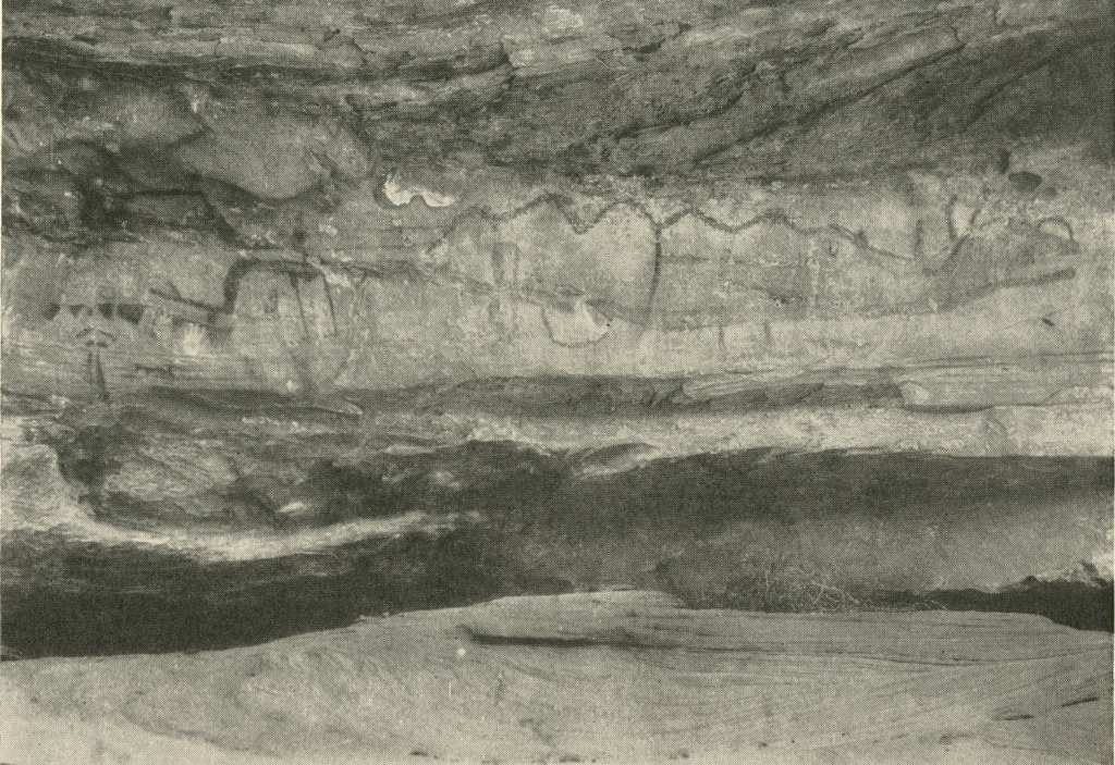
Image Number: 24277
We entertained great hopes concerning the region at the confluence of the Mora and the Canadian rivers, near the little village of Sabinoso. This lies far from any high road at the bottom of a deep canyon and the steep rocky trails gave Amaryllis a punishment from which she will never fully recover. We found Sabinoso to be about as unamericanized as any place in this land could be. No sound of radio or of phonograph, no movie posters or cigarette billboards, no word of English but our own, only the little scattered adobe houses with strings of scarlet chiles hanging from the roofs, and orchards of delicious apples and peaches. But none of the population knew of any Indian remains in the neighbourhood with the exception of arrowheads to be picked up in some places, and so we could not tarry there long. With two of us pushing behind over the worst places, we succeeded in getting Amaryllis out of the canyon. A picturesque little place, Sabinoso, but one not to be visited by anyone who treasures his automobile.
The next day took us to Tucumcari, a small but bustling city, largely a health resort. But it suffers from the lack of an archæologist and we could learn nothing concerning ruins on the Canadian River north of there. They may be there, or again there may be a gap between the Pueblo type of house which we found at Watrous to the west and the Texas type to the east. In several days’ search we found, north of Logan, a camp site of the nomadic Indians, of which sites there must be many in the neighbourhood. Here on the surface we picked up quantities of rubbing stones which were probably the manos used on metates, several of which latter we also found. The ground was thick with pulverized bones, broken fire stones, flint chips and a few flint artifacts and pottery fragments, the latter clearly of plains type. Another day we wasted in finding some rocks with carvings on them, which turned out to be of cowboy or sheepherder origin, and a third day afforded only some interesting mortar holes made in the rock ceiling which covered a small rock shelter.
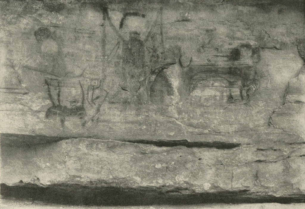
Image Number: 24278
From Tucumcari Mr. Satterthwaite had to return for the opening of the University, and Mr. Bache and I returned to Amarillo. We decided to do a few days’ more work on the Alibates Creek site before proceeding south, but on arriving there found our deserted ranch house preempted by two young Texans who, doubtless unknown to the ranch overseer in his headquarters fifteen miles away, were happily engaged in distilling mula blanca. Our approach must have brought up to them visions of handcuffs, but they soon recovered. We pitched our tent on a nearby hill, hoping that relations with our unwelcome but unavoidable neighbours would not become strained. At daybreak the following morning our good friend Mr. Studer appeared with a telegram recalling Mr. Bache to Philadelphia. Without doing a stroke of excavation we packed all our equipment and, despite Amaryllis’s frantic endeavours to break down in her vacuum tank, evidently sensing the loss of her last good driver, we reached the Santa Fé station just as the Missionary, eastbound, was shifting. In half an hour Amaryllis and I were alone.
The following day, September 19, we, in the Lindberghian sense, set off for the Rio Grande to spend the remainder of the expedition’s time and funds in southern Texas, where we hope to secure some data bearing on the interesting and important problem of the relationships between the higher cultures of Mexico and the southern United States.
Del Rio, Texas, September 28, 1929.
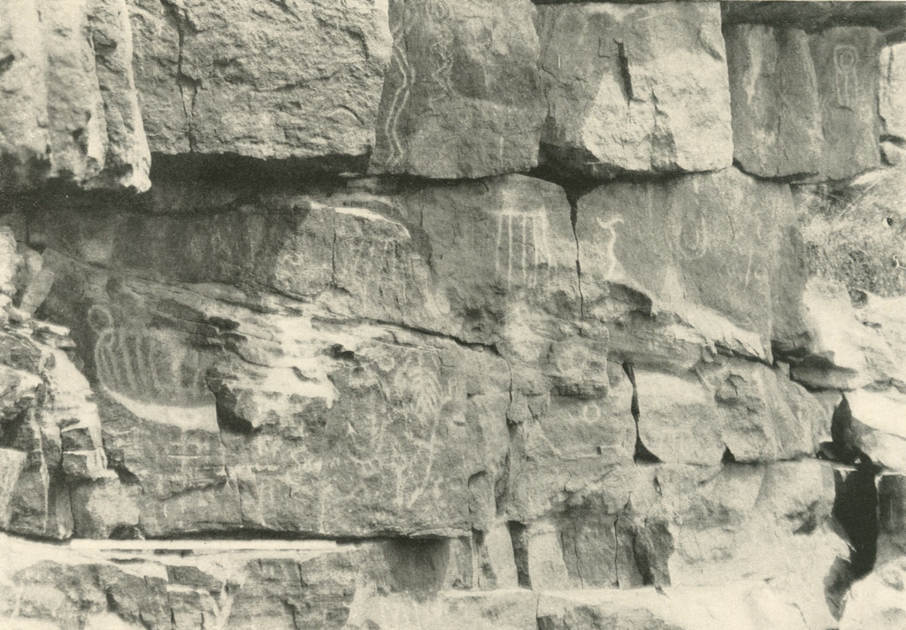
Image Number: 24194
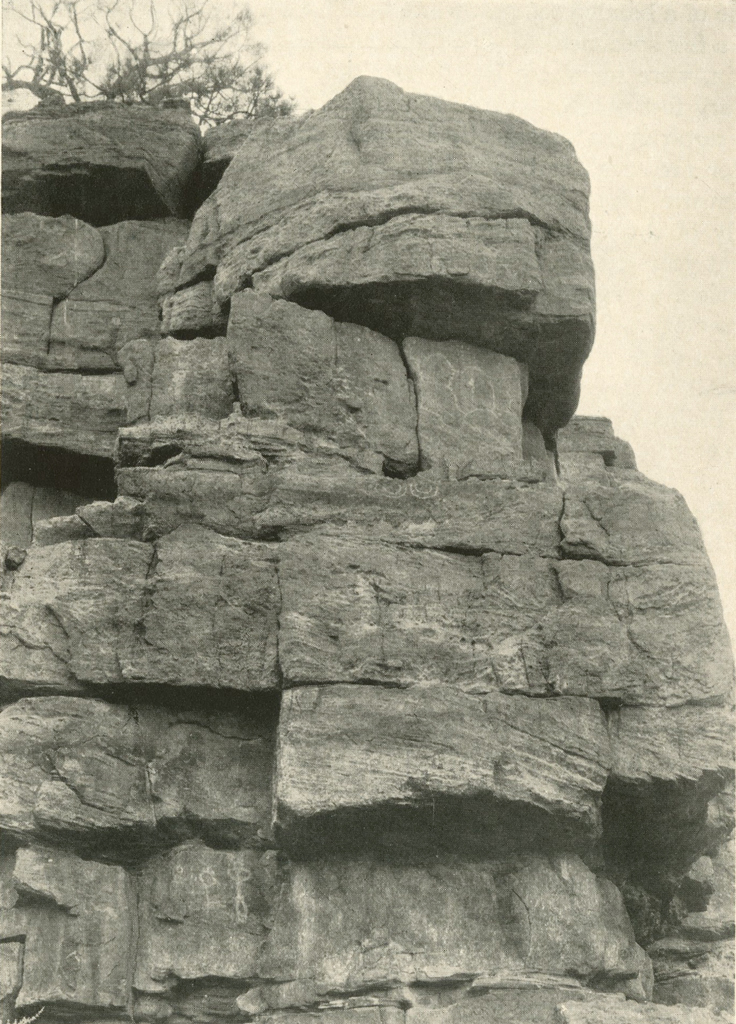
Image Numbers: 24193, 24194
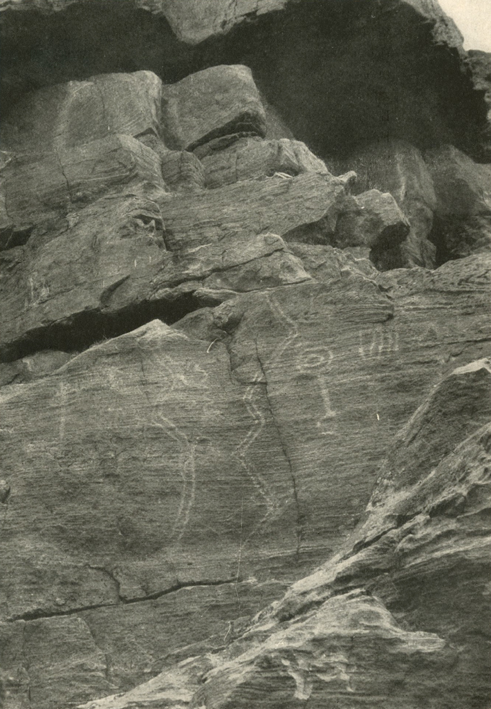
Image Numbers: 24195, 24196
1 Since this report was written, the first issue of the Bulletin of the Texas Archæological and Paleontological Society, Vol. I, Abilene, Texas, September, 1929, has appeared. Among other interesting articles are one by Dr. Ray and Mr. Sayles on the Abilene region, and one by Dr. Holden on the Canadian River district.↪