THE Beth-shean of Scripture, called Scythopolis by the Greeks and now the little village of Beisan, has been an object of scholarly interest ever since the modern scientific world turned its attention to the study of the history and topography of the Holy Land.
It is true that Biblical references are meagre and later Classical records do not give us much detailed information about the city, beyond establishing its reputation as a place of wealth and strength. Nevertheless, the strategic situation of the fortress at the eastern end of the Valley of Armageddon whence it must have overlooked so many decisive struggles between the Empires of the East and West, added to the enigma of the origin of the later name Scythopolis, have enshrouded the Tel in fascinating mystery.
During the Ottoman regime no effort could be made to solve this mystery. The site formed part of the private property of the Sultan; it lay in a fertile district considerably below the sea level; was noted for excessive heat, malarial climate and insecure political conditions. Under present guardianship rapid progress has been made in draining the neighboring swamps, and although there are still raids on the district by Bedawi from Trans-Jordania, the country is safe for excavation purposes. It was not uctil the Law of Antiquities of 1920 came into force under the British Administration that permission to excavate could be obtained. For some years our Museum had maintained an expedition in Egypt, completely-equipped and organized with a welltrained force of native workmen, so that as soon as the actual concession was granted it was only necessary to proceed to Palestine and begin work. Excavation started towards the end of June, 1921, and continued to the end of October.
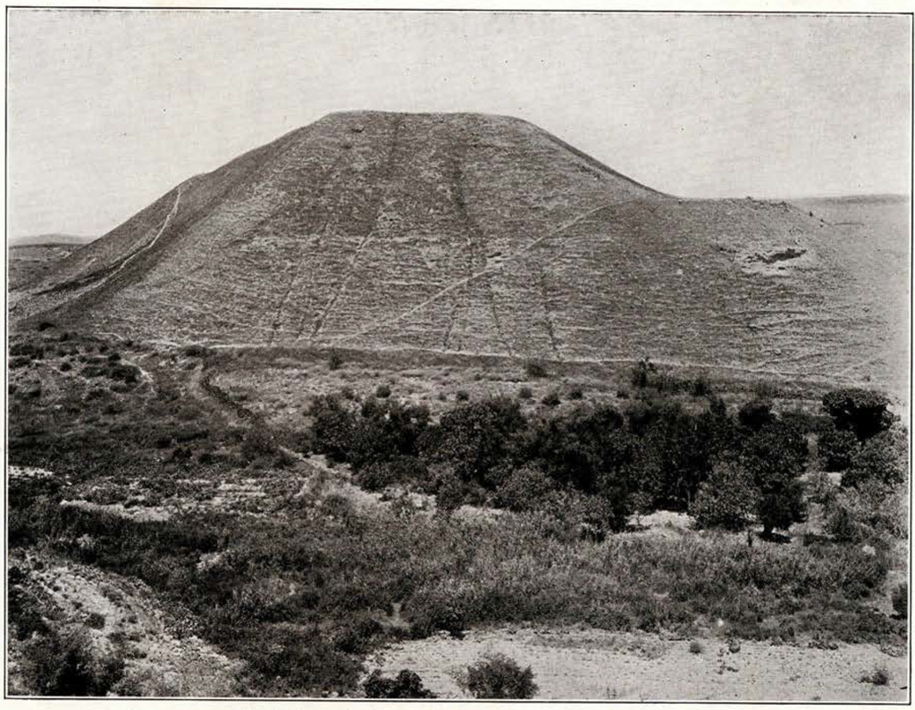
From the railway station only the top of the Tel is visible, rising above the edge of a plateau that still shows signs of one of the final Anglo-Turkish skirmishes. Here and there odd columns and bits of masonry suggest the presence of Greek or Roman villas, and the line of the old city wall can be traced along the north and west until it disppears in the distance behind the modern village. The hill stands at the junction of the river Jalûd and one of its tributaries. On reaching the edge of the plateau and looking across the deep ravine through which the main stream rushes, the full height and contour of the Tel becomes apparent and one realizes the majesty and impregnability of its position (Fig. 15). The slopes rise steeply, the only practicable ascent being on the west where a narrow path, no doubt following the line of an earlier causeway, leads to the ruins of a gate at the northwest corner. Inside this an almost level terrace extends round the eastern side of the hill, while a second on the west rises more steeply to the summit. The whole surface is clean and undisturbed. Not even the usual Moslem sacred shrine interferes with the complete investigation of the site.
The primitive fortress with the little town clustering around it occupied only the top and upper slopes of this rocky knoll, and from then onward the Tel was the nucleus of the city in its many stages of development. In the earlier Semitic periods growth was confined wholly to the saddle of land to the west sheltered under the lee of the citadel. By the classical period, Scythopolis, by which name it was known then, had developed into one of the great cities of the East, and the ruins of temples, theatres, and public buildings of this epoch cover an extensive area. To excavate these will be the task of many years.
The original portion of the site has of course the greater interest for us and here should be found the materials for the reconstruction of Semitic history and civilization. For this reason the expedition will devote the first few years to the complete clearance of this area. For the preliminary season I decided to limit our investigations to the top of the central hill. Some small trial cuttings were made to determine the boundaries of the terrace, and then a wide trench was carried into the eastern side of the upper slope to establish the vertical stratification from summit to rock. The strata exposed range from early Arab at the top down through Byzantine and Classical levels, each with its characteristic pottery, into a series of mud-brick walls associated with pottery of the Semitic periods. The lowest level reached contained a large circular structure approximately dated to 2000 B. C. Below this the debris continued with no signs as yet of the natural rock, thus proving the antiquity of the hill to be even greater than we had anticipated. At this level were several jars of thick rough gritty ware with a wash of hematite coarsely applied. On one was scratched a crude drawing of some long horned animal resembling an ibex. At a slightly higher level were two burials. The skeleton was that of a young woman laid on her side partly contracted in an enclosure formed by a single row of stones. In this were placed a number of earthenware vessels, the larger against the wall, the smaller behind the skeleton. The types are well known in Palestine as belonging to 1800-1600 B. C., contemporaneous with the expulsion of the Hyksos from Egypt. At the neck were a number of beads, two being of glazed quartzite.

Image Number: 41526
With the sequence of the strata ascertained it was possible to proceed at once with the systematic dissection of the hill. To facilitate the main work two separate areas were laid out, one including a large portion of the lower north and east terraces, the other embracing the entire summit. In each of these in turn a single stratum of buildings was cleared. The men were then transferred to the other area, leaving that just excavated free for the work of photographing, drawing and recording. Overlooking the lower terrace as we face towards the north we see the surface thickly covered with broken stones and projecting portions of granite columns. At the left is the mass of masonry froming one side of the entrance gate. In the background, just across the ravine lie the rock tombs of the ancient necropolis inside the line of the city wall. In the far distance are the tents of a squadron of mounted Indian troops, while nearer on the left is the original camp of our expedition—afterwards moved to the railway station.
At the close of the season the terrace had been cleared down through three levels. The topmost series of walls belong to the town built by the Arabs after their first conquest in 632 A. D. They were erected partly on the foundations of and largely with the material taken from preceding Byzantine and Early Christian buildings. The old columns, of black granite, were used mainly to strengthen the new walls, and were often found inverted or broken in half for convenience in handling. The heavier masonry on the left of the photograph is the lower terrace or inner enclosing wall connecting with the gate. Just inside this, re-used in a room, evidently a kitchen, we found a large marble stele. This bore a Greek inscription commemorating the restoration of the city wall at the instance of Flavius Arsenius during the local magistracy of Flavius Leon. Some years ago another similar slab was unearthed at Beisan and is now in the house of the District Officer there. This refers to the same work of restoration but gives in addition the name of the Emperor Flavius Anastasius which establishes its date as probably 509-510 A. D. A certain Flavius Arsenius is known to have possessed great influence at the Court of Byzantium about 530 A. D., which he is said to have exercised in the interest of Scythopolis, probably because it was his birthplace. The dates in the two inscriptions are a year apart. As the restoration of the city wall was a work of considerable magnitude extending over several years probably a tablet was inserted in the face of each completed portion. In the debris we found a number of bronze lamp frames, vessels and fragments of fine mosaic, undoubtedly belonging to the Christian Church on the summit, of which we shall speak later.
The original Byzantine buildings appear from their plan to have been used as barracks or storerooms. Quantities of burned wood and badly broken and smoke discolored mosaic floors proved that they had been destroyed by fire. Water from the roofs was carried off through round pipes usually built into the angles of the walls and under the floors to cisterns. All connections were rendered watertight by a coating of cement. Waste water was conveyed through stone or brick drains lined with plaster and covered with tiles to outlets in the exterior walls.
Below this level was finely preserved masonry of a third period not yet fully cleared. The stones were regularly coursed and laid in the system usually associated with Roman work.
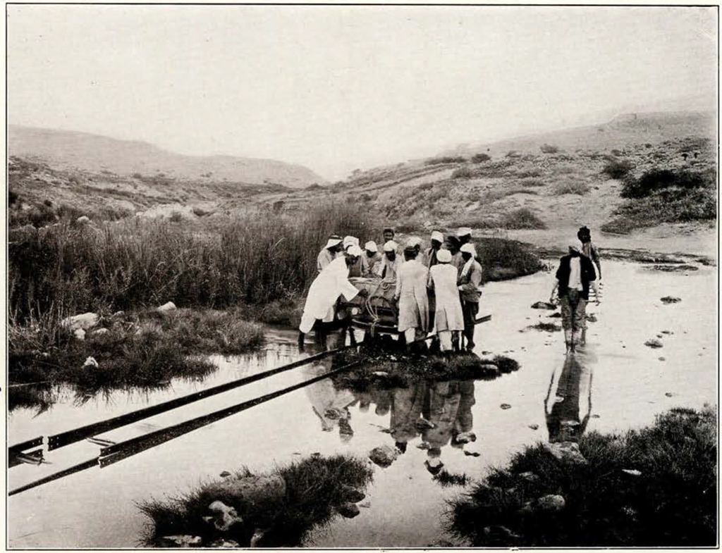
Image Number: 30116b, 30124, 41619
The large buildings on the lower terrace did not extend as far as the gate, a considerable space between being filled in with poorly constructed houses and a vaulted chamber, probably a cistern. In its present form the gate is not earlier than the Byzantine or may be even as late as the Arab period. It was, however, built on the site of an earlier entrance clearly marked by the lines of the original pavement and by some massive foundations just outside the opening. Blocks of varying shapes, drums and capitals of columns and pedestals had been used in the side walls of the gate, and at a still later period, a casing of rough stones had narrowed the road inside the wall. The gate itself was no doubt closed with heavy wooden doors turning in stone sockets and fastened by a thick bar, which when not in use slid back out of sight in a deep channel left in the masonry. This recess as well as the shallower one on the opposite side in which the end was held was found intact. The street inside the gate extended some 30 metres eastwards in a gentle incline, then made an abrupt bend to the south. Beyond this point it has not yet been followed but clearly ascended to the summit. The earlier paving stones were placed systematically, while later repairs, of larger blocks, had been laid less regularly.
The summit offered for the most part a fairly level surface with several small rubble walls still traceable. An angle of heavy masonry projected at the northwest, while along the southern end a low ridge of debris suggested the existence of some large structure. The first stratum uncovered here contained another part of the Arab town, the floor level only ½ to 1 metre below the surface. A wide straight street, orientated nearly due east and west, divided it into two equal parts. The majority of the houses were constructed in accordance with this axis and only near the east edge, where existing walls had been utilized, did certain of the rooms lack symmetry. Narrower passages branched off north and south from the main thoroughfare, that to the north being paved with stone. The surface of the main street had large patches of pavement composed of fragments of white marble tiles roughly relaid. Three fine Byzantine capitals and a base, of white marble, had been set up as seats beside the outer doors of houses. Near the western end, half buried in the filling of the street, was a shaft of green and white streaked marble with three inscriptions on the upper exposed surface. One was in Hebrew script of about the 8th century, the other two in Arabic. The more legible of the latter stated that it had been written by ” Mohammed the son of Saeed the son of Il Khattab the Sahabi in the month of Rabee the second in the year 170 A. H. ( = 784 A. D.).
On the right of the street, near the shaft was a small room used as a mosque with a mihrab (prayer niche) modelled in white stucco. The floor was of white plaster concealing a mosaic of squares and crosses, that was later found to form part of a larger scheme. Other sections of mosaic of different patterns were uncovered in the same vicinity. These were all partly built over by the later walls and clearly belonged to an earlier non-Moslem structure. We had already found in the debris of the slope numerous pieces of carved marble copings and terraces pointing to the existence of an important edifice on the summit, possibly a Christian church. This became more probable after the removal of the ridge at the southern end had revealed a small vaulted monastic building. At the eastern end was a bakery, with an oven built in two superimposed parts. The lower furnace compartment was covered with a flat dome of baked brick. The fire was replenished through a short low arched tunnel connected with a tiny outer enclosure. The oven above, of similar construction, had a door with a wide projecting ledge or counter opening into the main room. Here were found fragments of several large flat basalt millstones. As there could not have been power at this elevation sufficient to operate a grist mill, these must have been brought here for some other purpose.
Next to the bakery was a large cemented cistern with a barrel vault rising above the level of the neighboring floors. The opening on its top platform from which the water was drawn, was reached by a short flight of narrow steps.
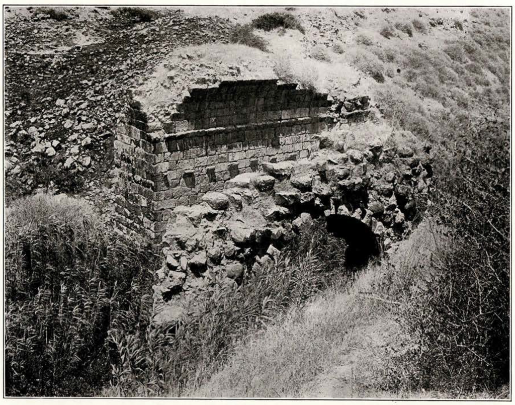
Image Number: 41530, 30116a
Almost half of the lower floor of the monastery was occupied by the refectory. Over this was perhaps the dormitory, as outside the wall were the remains of a double staircase. The refectory had tables and seats lengthwise of the hall. A course of beautifully dressed and fitted masonry—left from a previous wall—served for the table on the right, while several broken columns supported either a wooden or a stone top on the left. Stone benches were built in between the vaulting piers on either side, and rows of rough blocks formed seats down the centre. A sarcophagus at one end provided a place for ablutions.
I had presumed that the church had been built in the usual basilica style. When the excavations disclosed only the vestiges of mosaic floors it appeared as though the whole structure, if such had existed, must have been swept away completely by the Moslem conquerors. It was therefore without much hope of finding anything beyond such portions of foundations as might have been spared in the wholesale destruction and subsequent rebuilding, that I began the removal of the Arab houses. But almost at once the workmen came upon several large door sills. Their positions did not conform to any possible rectangular plan and were arranged radially, whether from a common centre or not could not be determined at the moment. By following out the foundations on which they rested a circular church was brought to light. There are several churches with this form dating to the 7th century A. D., known in Palestine and Syria. That at Bosrah in the Hauran is a close parallel to the one just excavated at Beisan. Our building is practically complete as to plan and sufficient material was found to give us a fairly accurate conception of its details.
Across the entire western front, at right angles to the main axis, extended a vestibule, floored with small squares of red and white stone tiles laid diagonally within a narrow marble border. This had no traceable entrance at the front, but at the northern end were remains of a flight of steps approached by a sloping causeway similar to that at the gate. The vestibule gave access to the main part of the church, about 36 metres in diameter. The heavier of its two concentric foundations carried the exterior wall which had doors into chambers at the corners, making it appear approximately square in plan. The inner wall had a wide coping and supported columns. Eight of these have been found and while the exact position and arrangement cannot be determined with accuracy, the fact that the columns lay in pairs and certainly not very far from their original positions around the wall, suggested a series of wide openings each divided by two shafts alternating with solid walls. The capitals and bases had all been removed and only the four found in the upper stratum and two additional bases recovered from the debris in the monastery seem to have been preserved. They were of white marble. The bases had the usual Attic contour and the Corinthian capitals were of good proportions and well cut details. The shafts, of slightly varying dimensions, averaged 4.20 metres in length. Others besides the one already mentioned as found in the Arab street bore rudely chiselled Arabic inscriptions. At the eastern end of the axis was the apse, a long and rather narrow chamber with a semicircular end projecting well beyond the line of the rear wall. Of this only the incomplete foundation walls remained. The continuity of the columned portion of the rotondo was intercepted by the side walls of the apse and another section adjoining the vestibule had likewise been partitioned off. The latter was paved with the square patterned mosaic mentioned previously as having been uncovered in the mosque. The other parts had floors of black and white stone squares laid diagonally. On either side of the entrance from the vestibule had been large niches with mosaics specially designed for the semicircular plan. Only the one at the southwest was in situ and near it were found two jars containing tiny gilded and delicately colored red, yellow, blue and green glass tesserae. Unfortunately no clue could be obtained to the decorative scheme. In early churches the use of such tesserae was restricted to the upper portions of walls and to the interior of domes.
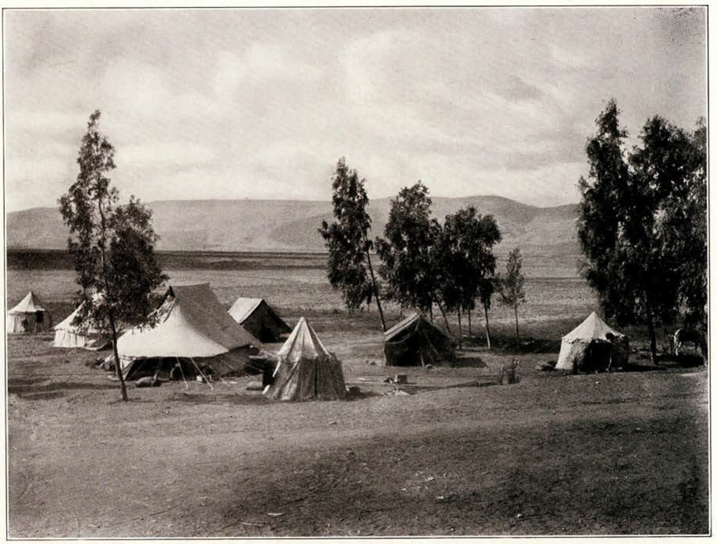
Image Number: 41630, 30116a
The central rotondo had a floor paved with white marble flags which was slightly lower than the rest of the church. It was probably domed. A channel extending around nearly the whole circumference doubtless served to collect and carry off the water coming through an opening in the dome. This canal and others from different chambers drained into the large cistern in the monastery.
The interior of the church was lighted with bronze lamps suspended from the ceiling by chains of the same material. A number of nearly perfect specimens have been found already. They were round or square frames with four or six holes for the glass receptacles containing the oil. Precisely similar lamps are used throughout the East in modern times.
As the work proceeded it became more and more apparent that the circular church had after all been built over an earlier rectangular basilica—either early Christian or late Roman. There is evidence that the vestibule and the room at the northwest formed part of this building, and had been incorporated in the new plan. The floor in the former is similar to one of red and white tiles in a large rectangular room behind the eastern apse, where part of the later floor of the rotondo had been laid over the tile work. In the northwestern chamber the mosaic displayed better technique. The design was of alternate large and small interlacing circles each with bands of black, red and yellow tesserae on a white ground. The border was the usual guilloche in similar colors. It had been burned and the circular walls had cut off one of its corners.
The first basilica had a drainage system conforming to its rectangular plan, but being on the same level the canals had been cut through and partly blocked by those of the later building. They had drained into an entirely different cistern east of the vestibule found partly filled with drums of large columns and fragments of architectural members of corresponding scale.
During the excavations on the summit a vertical shaft was sunk near the southwestern side where no pavements or walls were in situ. At a depth of 2 r z metres from the surface we found a large basalt stele with an Egyptian inscription of Sety 1, 1313-1292 B. C. This lay on its side, with one edge broken away and the inscribed
face badly weathered. It was not in its original position and had evidently been reused, as the upper portion containing part of a relief panel had been cut off. The stele bears twenty lines of hieroglyphs in which mention is made of the Syrians. So far as it has been deciphered the inscription is made up mainly of the usual laudatory attributes of the king.
Throughout the entire period of four months the work of the expedition progressed smoothly and rapidly due in no small measure to the assistance rendered by the various Departments of the Government of Palestine. The portable railway lent by the Department of Antiquities greatly lightened the labor of excavation. The Railway Administration, besides granting special transport facilities, permitted us the use of the waiting room of the Beisan station as an office and storeroom for our records and finds. It is with great satisfaction that we look forward to carrying on in future years under such kindly auspices.
C. S. F.